Central Valley Temperature Mapping and Prediction (CVTEMP)
National Oceanic and Atmospheric Administration (NOAA) Southwest Fisheries Science Center (SWFSC)
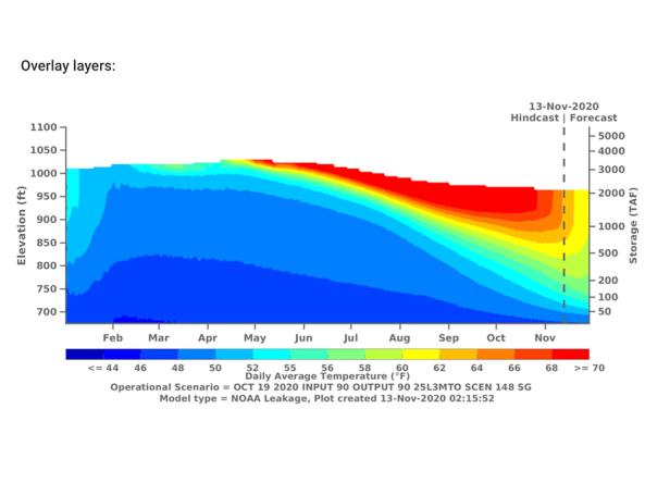
The public interface for modeled and observed water temperature and flow data for the Sacramento River associated with Shasta Reservoir, Shasta Dam operations, and meteorological conditions. A primary input and assumption of the models is based on the operational conditions forecasted for Shasta and Keswick reservoirs generated by U.S. Bureau of Reclamation. These forecasts are updated over time and composed of different scenarios of hydrological (dry or wet) and meteorological (warm or cool) conditions. Model outputs from each scenario are displayed.
How to
How to use this site:
- Use the table of contents (on the left) to navigate between different models to view observed and forecasted data for watersheds, reservoirs, rivers, and meterological variables.
Access
CVTEMP: homepage for the Central Valley Temperature Mapping and Prediction (CVTEMP)