Decision Tools for the Soil Climate Analysis Network (SCAN)
U.S. Department of Agriculture (USDA) Natural Resources Conservation Service, USDA Climate Hubs, Northeast Regional Climate Center
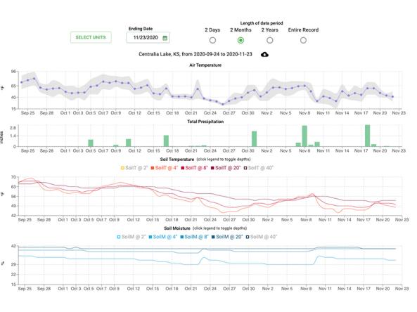
This site provides decision tools and resources using data from weather stations in the SCAN and Tribal SCAN networks.
The U.S. Department of Agriculture's Natural Resources Conservation Service (USDA NRCS) operates a comprehensive, nationwide soil moisture and climate information network. The Soil Climate Analysis Network, also known as SCAN, supports natural resource assessments and conservation activities through its network of automated climate monitoring and data collection sites. SCAN focuses primarily on agricultural areas of the U.S., Puerto Rico and the Virgin Islands. The network consists of over 200 stations in almost every state, and is growing every year.
In addition to the original SCAN project, NRCS also operates a soil moisture and climate information network on Tribal lands. The Tribal Soil Climate Analysis Network (known as Tribal SCAN, or TSCAN) focuses on agricultural areas which are situated on Tribal lands in the United States.
These decision tools use SCAN data to address a variety of agricultural applications. Each tool utilizes the Applied Climate Information System (ACIS) web service for fast, easy and reliable access to SCAN data.
Documentation
More information about these networks is available at the NRCS website:
Documentation for individual SCAN decision tools can be found below: