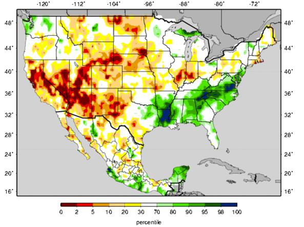
Experimental Surface Water Monitor
University of Washington (UW), University of California Los Angeles (UCLA)
Forecasts and current conditions for soil moisture (SM) and cumulative runoff. Forecast maps include percentiles at one-, two- and three-month leads.
How to
What can I do with these data?
- View forecasted, current or cumulative surface water conditions.
How do I use the site?
- Roll your cursor over or click the names/labels of products to view the maps.
- To save image, right-click the map and select “Save Image As...” in GIF format
- Archived images, from 1915-2016, are located in the left menu bar
Access
Experimental Surface Water Monitor Current Conditions – home page for the University of Washington’s Experimental Surface Water Monitor for the Continental U.S. maps
Experimental Surface Water Monitor Predicted Soil Moisture Percentiles – median and probability maps at one-, two- and three-month leads
Documentation
For details about the genesis and implementation of the Surface Water Monitor see: Wood, A.W. 2008, The University of Washington Surface Water Monitor: An experimental platform for national hydrologic assessment and prediction, in Proceedings of the AMS 22nd Conference on Hydrology, New Orleans, LA, January 20-24, 2008


