Historical Water Watcher
Pacific Northwest Climate Impacts Research Consortium (CIRC, a NOAA CAP team), University of California, Merced
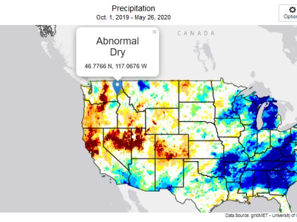
Part of the Climate Toolbox, the Historical Water Watcher is a tool that provides maps and summary tables of different drought types, such as agricultural and meteorological drought, for locations in the contiguous United States. The tool allows users to compare these conditions to the latest U.S. Drought Monitor (USDM) map.
The Historical Water Watcher allows users to investigate the different extreme conditions of drought in different categories, improving over the USDM's single drought classification for a region. The extreme wetness of a region can also be investigated in a symmetric extension of the USDM's drought classification. Through zoomable maps and location-specific graphs, a finer-scale view of drought can be obtained than from the USDM.
How to
- Use the Options tool in the upper right corner of the map(s) to select the variable and time period of interest.
- Select the "Take Tour" option in the upper right corner of the home page to learn more about the tool and its features.
Documentation
Full documentation can be viewed by clicking the "Documentation" tab in the upper right corner of the Historical Water Watcher home page.
This includes an overview of the tool; definitions of each variable and corresponding dataset(s); data source, period of record, and other metadata information for each dataset; and a description of the calculations used in the tool.