National Water Dashboard
U.S. Department of the Interior (DOI) U.S. Geological Survey (USGS)
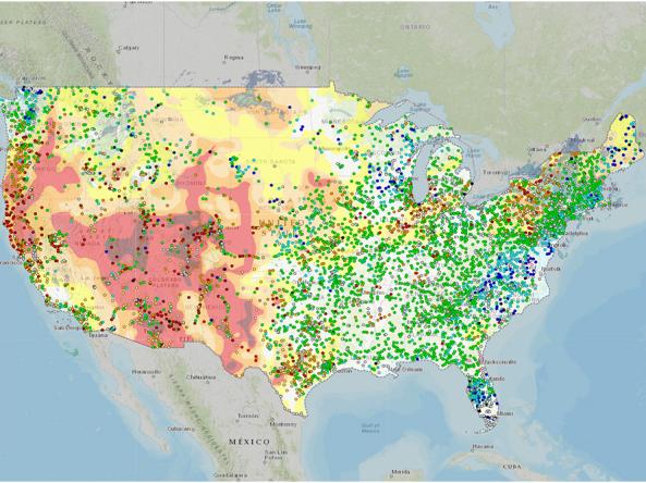
The U.S. Geological Survey (USGS) National Water Dashboard is an interactive map viewer that shows provisional real-time stream, lake, reservoir, precipitation, water quality, and groundwater data from more than 13,500 USGS observation stations across the country. This information is shown along with NOAA weather data, such as radar, watches and warnings, past precipitation totals, precipitation forecasts, and drought conditions from other open water-data sources. The Dashboard also links to the USGS WaterAlert system, which sends out instant, customized updates about water conditions
Access
National Water Dashboard: Interactive map viewer show real-time USGS water data in context with weather data from other public sources
Data Download: Data cannot be downloaded from the National Water Dashboard, but can be downloaded from the National Water Information System website.