NCEI Past Weather Tool
National Oceanic and Atmospheric Administration (NOAA) National Centers for Environmental Information
The NOAA National Centers for Environmental Information (NCEI) Past Weather Tool allows users to search for historical temperature, precipitation, snowfall, and snow depth data for individual weather stations across the United States, as well as many international locations. Stations are part of the GHCN (Global Historical Climatology Network)-Daily dataset.
Access
How To
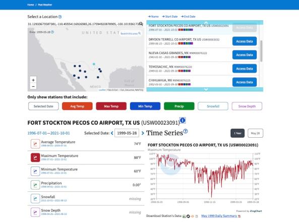
- Use the search bar to enter a location of interest (e.g., city, address, zip code). Or, use the map to find a location by using zoom/pan or Shift+Click+Drag and then click "Search this area.” A set of stations from that location will be displayed (if any exist). Select the desired station from the list or from the map to view available daily data for that station.
- Adjust the date in the “Selected Date” field and select a dataset (average temperature, maximum temperature, minimum temperature, precipitation, snowfall, or snow depth) to view a time series for that indicator.
- Above the time series, click the “1 year” button to view a time series for 1 year through the selected date. Click the button with the selected date to view the values on that date every year over the full period of record for that station (e.g., the average temperature every August 25 from 1962 to 2021 for Lakewood, CO).
- Use the links below the time series to download the data or a PDF monthly weather report for that station.
- For more information, click the “i” icon next to the station name. A popup will provide links to station history and further details through the Historical Observing Metadata Repository (HOMR).
Documentation
All stations are part of the GHCN (Global Historical Climatology Network)-Daily dataset. GHCN-Daily data may lag by a few days due to a comprehensive set of quality assurance checks. Only data with blank quality flags (i.e., that did not fail any quality assurance checks) are returned.


