USBR Hydromet: Reservoir Storage
U.S. Bureau of Reclamation
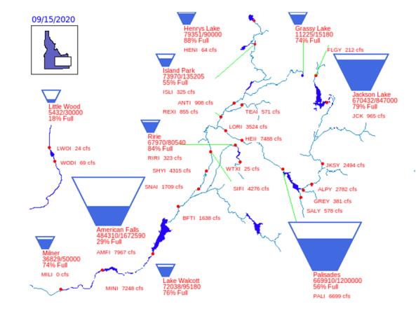
Reservoir storage "teacup" diagrams for U.S. Bureau of Reclamation (USBR) dams in the Pacific Northwest region. USBR provides average daily streamflows and reservoir storage levels for several river basins.
Reservoir data comes from the USBR's Hyrdomet, a network of automated hydrologic and meteorologic monitoring stations located throughout the Pacific Northwest, as well as their associated communications and computer systems.
How To
- Select a river basin to view "teacup" diagrams for that region:
- Rogue River Basin, Oregon
- Tualatin River Basin, Oregon
- Umatilla River Basin, Oregon
- Crooked and Deschutes River Basins, Oregon
- Eastern Oregon river basins (Owyhee, Malheur, Burnt, Powder)
- Boise and Payette River Basins, Idaho
- Upper Snake River basins, Idaho-Wyoming
- Lewiston Orchards, Idaho Project
- Yakima River Basin, Washington
- Coulee , Columbia Basin Washington
- Hungry Horse-Coulee ESA Data
- Within a region, select a reservoir to view its reservoir storage graph.
- Select a gaging station (red dots) to view a streamflow hydrograph for that station.


