National Groundwater Monitoring Network
U.S. Geological Survey Office of Water Information
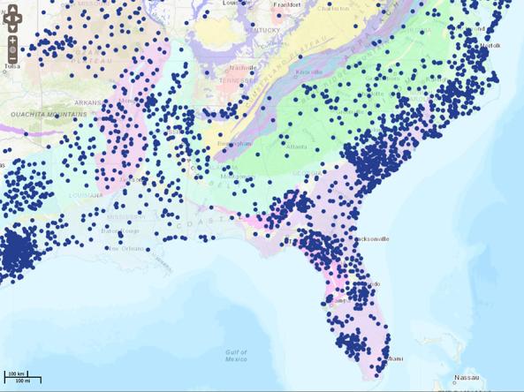
The National Groundwater Monitoring Network (NGWMN) is a compilation of selected groundwater monitoring wells from federal, state, and local groundwater monitoring networks across the nation. The NGWMN Data Portal provides access to groundwater data from multiple, dispersed databases in an interactive map. The portal contains current and historical data, including water levels, water quality, lithology, and well construction.
The goal of the NGWMN is to provide information needed for planning, management, and development of groundwater supplies to meet current and future water needs and ecosystem requirements. A consensus-based framework document was developed to provide guidance to ensure that the data are comparable and can be included in a nationally consistent network. The framework design focuses on providing information needed to assess the quantity of groundwater reserves as constrained by quality. The network focuses on Principal and Major Aquifers of the United States.
Access
National Groundwater Monitoring Network: Home page
Data Portal: Interactive map with current and historical groundwater data, including water levels, water quality, lithology, and well construction
Learn More: About the Network, the Data Portal, and current data providers