Organic Soil Moisture Monitoring in Coastal North Carolina: Assisting Coastal Zone Fire Risk Monitoring and Management
The State Climate Office of North Carolina has initiated a project to address needs regarding coastal zone fire risk. This effort includes installing monitors to collect data on soil moisture and weather at several locations in coastal North Carolina with organic peat soils. Monitoring data is integrated into an existing resource, the Fire Weather Intelligence Portal, to better address coastal fire conditions and risks. This system is intended to address identified challenges with fire risk measurement in organic soils and provide real-time information for fire risk decision making in this region. Agencies that will use this information to better manage their lands and conduct prescribed burns include the NC Forest Service, NC State Parks Service, US Fish & Wildlife Service, and The Nature Conservancy.
Organic soils, drought, and wildland fires in the Coastal Carolinas
Heavily organic, peat soils are found in many parts of eastern North Carolina. These soils are made up of partially decomposed plant matter submerged in low-water oxygen. During droughts, peat soils lose moisture, and certain farming practices and drainage modifications (canals or levees) can dry these soils even more. When wildland fires occur in these regions, peat soils can ignite, leading to severe and long-lived ground fires that produce dense smoke and cause air quality and traffic safety concerns.
Establishing an organic soil moisture monitoring network
The complex terrain, drainage, and composition of peat soils make it difficult to assess fire risk in coastal regions, and existing drought indices may miss periods with heightened fire risk. This makes it difficult to plan prescribed burns or allocate fire-fighting resources to at-risk locations. Few real-time monitoring stations have historically been present in these often-remote areas.
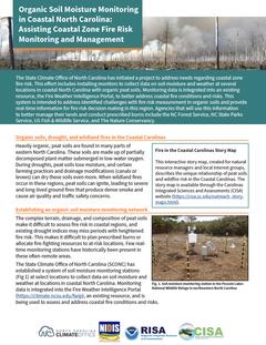
The State Climate Office of North Carolina (SCONC) has established a system of soil moisture monitoring stations at select locations to collect data on soil moisture and weather at locations in coastal North Carolina. Monitoring data is integrated into the Fire Weather Intelligence Portal, an existing resource, and is being used to assess and address coastal fire conditions and risks.
Accessing the data from the Fire Weather Intelligence Portal
As of December 2019, four monitoring stations are operational. Current and archived data from the Organic Soil Moisture (OSM) stations are accessible on SCONC’s Fire Weather Intelligence Portal.
Users of the Fire Weather Intelligence Portal can view maps with conditions at all stations for a single time, as well as meteograms for each station that show the change over time. Weather parameters measured from these stations that are viewable on the Portal include air temperature, relative humidity, and precipitation. Volumetric water content is measured at five different depths (5, 10, 20, 50, and 100 centimeters) at each station and averaged across three sensor columns. These values are converted to gravimetric moisture content and Estimated Smoldering Potential – two parameters which are commonly used with organic soils.
Applications of station data for drought early warning and fire management
Resource managers are using the provided data and information to monitor on-the-ground conditions, and make decisions related to fire fighting and prevention including organizing resources, increasing or activating personnel, communicating with the public, and planning park or refuge closures.
One benefit of this monitoring network is that it allows users to access the data and information about remote conditions in real-time. It saves personnel time and resources required for field visits, facilitating a more timely response to changing conditions.
The monitoring data are also informing longer-term planning and research. For example, The Nature Conservancy is using the data to compare and assess the benefits of different land restoration methods and efforts in the Pocosin Lakes National Wildlife Refuge.
Next Steps
Recommended future activities include ongoing maintenance of the OSM stations, research to explore the potential for data from these stations to inform coastal zone fire risk and the use of proxy datasets, and engagement with stakeholders and decision makers to understand how this information supports their fire management efforts in the region.
Questions or Suggestions?
For more information, please contact Corey Davis (cndavis@ncsu.edu (link sends e-mail)).
Key partners include the NC Forest Service, The Nature Conservancy, and NC State Parks, and US Fish & Wildlife Service. Ongoing meetings and consultation with partner organizations have been used to gather and incorporate feedback into the management of monitoring stations, collection of soil samples, and visualization of gathered data. The SCONC is a member of the NC Fire Environment Committee, which provided input into this project.
This project builds on findings and recommendations from the Coastal Carolinas Drought Early Warning System (DEWS), a collaborative federal, state, and local interagency effort to improve early warning capacity and resilience to drought. Support has been provided by National Integrated Drought Information System (NIDIS) and the Carolinas Integrated Sciences and Assessments (CISA) program. CISA is funded by the National Oceanic and Atmospheric Administration’s (NOAA) Regional Integrated Sciences and Assessments (RISA) program. The Nature Conservancy, through the US Fish & Wildlife Service, provides support for a fourth monitoring station.


