Climate Engine: Enhancing On-Demand Cloud Computing and Visualization of Drought and Remote Sensing Data

In an era of an increasing wealth of earth observations, approaches for quickly accessing, analyzing, and visualizing these environmental data to better inform decision making at relevant scales is lacking. Specifically, there is a need to quickly process and visualize data to improve monitoring and early warning of drought (including snow drought), groundwater dependent ecosystems, fire danger, and crop-failure risk. In response, the Desert Research Institute and University of Idaho, with support from the National Integrated Drought Information System (NIDIS) since 2016 and in partnership with Google and other federal partners, have developed ClimateEngine.org ― an innovative web application that enables users to quickly process and visualize satellite earth observations and gridded weather data for environmental monitoring.
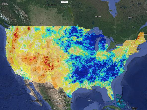
Climate Engine, an example of a public-private partnership, is an “on-demand” cloud computing and visualization of climate and remote sensing data resource. Climate Engine enables users to analyze and interact with climate and land surface environmental monitoring datasets in real-time. In addition to providing early warning, Climate Engine can help improve decision making related to water sustainability, water efficiency, agricultural productivity, and ecological health.
Utilizing access to one petabyte (1,000 terabytes) of cloud storage and 50 million donated hours of computing time on Google’s Earth Engine environmental cloud computing platform, the web-based application is able to mine, process, and analyze a 30-year archive of high-resolution optical and thermal images taken of Earth by the Landsat satellites in a matter of seconds compared to hours and even days with traditional computing systems.
In 2019, NIDIS supported two Climate Engine training sessions: one in April 2019 with the Navajo Nation and the other in October 2019 in Reno, Nevada, with the Nevada Bureau of Land Management (BLM). The purpose of the trainings, which built on a "roadshow" of Nevada BLM trainings in 2018, was to empower decision makers to use the tool for decision support related to drought, water use, agriculture, wildfire, and ecology including local scale information for assessing field scale impacts — such as vegetative drought (short-term soil moisture deficits) and hydrologic drought (long-term water deficits and low river flows).
Research Snapshot
What to expect from this research
NIDIS is continuing to support the advancement of Climate Engine, including exploring the future of cloud computing and data storage for drought decision making and for utilization on Drought.gov.
Related Data & Maps
Climate Engine allows users to analyze and interact with climate and earth observations for decision support related to drought, water use, agricultural, wildfire, and ecology.
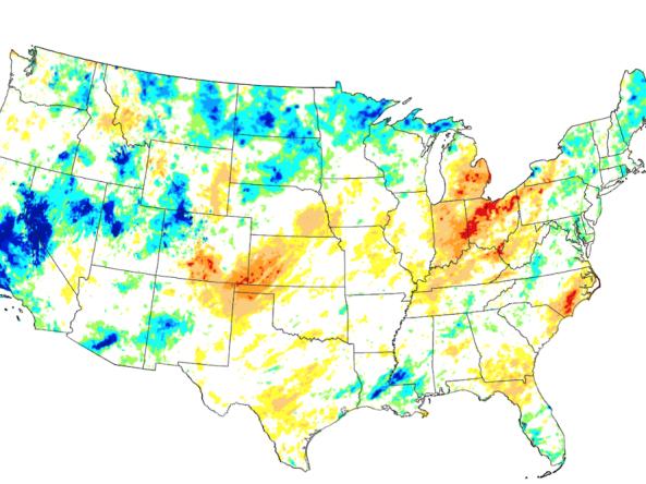
These experimental drought blends integrate several key drought monitoring products and indices into a single short-term or long-term product, based on the methodology developed at the NOAA Cl


