Drought.gov Launches New Map Feature for Tribal Nations
While drought is a normal part of climate, it presents many challenges, especially as we face rising temperatures and increasing instances where water supply is no longer meeting demand. Tribal Nations contend with barriers and drought data gaps, such as the lack of monitoring on tribal lands, but nonetheless, have long shown their resilience to drought and have communicated the need for tools and resources to help manage it.
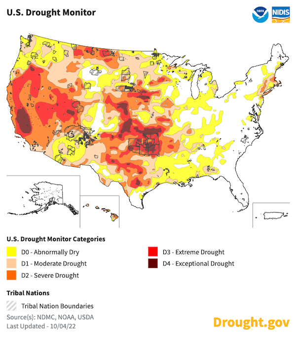
In response to these needs expressed by tribal partners, NOAA's National Integrated Drought Information System (NIDIS) is pleased to announce a new map customization feature for Tribal Nations. Developed in collaboration with NOAA’s National Centers for Environmental Information (NCEI), this feature allows users to display reservation boundaries on any map on Drought.gov.

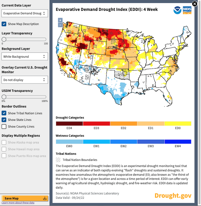
Users can display boundaries for the more than 300 reservations across the U.S. from the U.S. Census Bureau, overlaying reservation boundaries on any of the maps available on Drought.gov. By clicking the download icon in the top left corner of any interactive map on the website, any national map can become a local map, showing key drought and climate indicators—such as precipitation, evaporative demand, and soil moisture—for tribal lands across the United States. This provides a valuable tool for both drought monitoring and communications.
Other customization options include the ability to zoom in or out, display state or county lines, adjust the transparency of map layers, hide or display the map description, change the basemap, display any map layer alongside the current U.S. Drought Monitor, and download a high-quality PNG file of a customized map.

NIDIS and NCEI launched the new Tribal Nation Boundary map feature in direct response to the NIDIS Tribal Drought Engagement Strategy, which NIDIS developed in close consultation with 22 tribal natural resource managers across the Missouri River Basin and Midwest. The Strategy aims to integrate indigenous perspectives into NIDIS’s work, and by doing so, NIDIS hopes to foster a culturally appropriate engagement practice and work with Tribal Nations as equal partners in preparing for and responding to drought.
One key challenge identified by tribal partners is limited reservation-specific monitoring and forecasting data, as well as the absence of tribal boundaries on drought maps and communications. It is vital that the boundaries of these sovereign nations are represented on drought maps and other communication materials, as would be the case for other nations. The new Tribal Nation Boundary map feature is a step toward addressing this need.
Going forward, NIDIS intends to hold listening sessions with tribal partners to learn how the U.S. Drought Portal, Drought.gov, can serve Tribal Nations better. Learn more about the NIDIS Tribal Drought Engagement Strategy, or visit our Tribal Nations page for drought monitoring, planning, and impact information.
Have questions or feedback on this new feature? We’d love to hear from you! Reach out to the U.S. Drought Portal team at drought.portal@noaa.gov.


