New Research to Better Represent Agricultural Drought
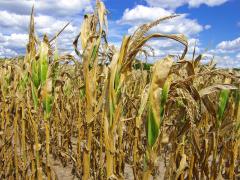
The agricultural sector is an important contributor to the nation’s economy, from providing jobs to promoting food and energy security. In 2015, farms contributed $136.7 billion to the U.S. economy, with an additional $855 billion from other agriculture- and food-related sectors. Drought can have significant negative impacts on the agricultural industry, so accurate monitoring and forecasting are critical.
Land-surface models (LSMs) play a key role in the monitoring and forecasting of drought. LSMs simulate processes happening at the Earth’s surface, like estimating how much water is exchanged between the land and the atmosphere (i.e., water budgets). The accurate representation of vegetation, and therefore drought, in LSMs has been a challenge, and climatologically-based maps or generalized tables of vegetation states are often used and can lead to misrepresentation.
By utilizing an LSM that incorporates a dynamic vegetation scheme, like the Noah-multiparameterization (Noah-MP) LSM, studies have found more accurate representation of drought. However, some research has also indicated that future improvements of vegetation within the Noah-MP LSM are needed to more accurately represent agricultural areas.
A new study published in the Journal of Hydrometeorology builds on previous research by Kumar et al. 2019b to evaluate the impact of assimilating Leaf Area Index (LAI) observations on the Noah-MP LSM’s ability to estimate agricultural drought. Data assimilation involves combining observations with numerical model data to determine the initial conditions used within the model.
In the study, NASA researchers David Mocko, Sujay Kumar, Christa Peters-Lidard, and Shugong Wang assimilated LAI into the Noah-MP LSM, and then evaluated the simulation results against drought categories from the U.S. Drought Monitor, as well as in situ soil moisture observations. The result was an improved ability to represent drought intensity and extent, especially over cropland areas.
The results show that incorporating vegetation observations into the LSM:
- Improves the simulation of the drought category and extent
- Improves detection of drought conditions, particularly in agricultural locations likely to be undergoing irrigation
- Reduces instances of drought false alarms.
The authors found that assimilating LAI not only corrects model errors in simulating vegetation, but also helps represent physical processes like irrigation to improve model simulation of agricultural drought. Without the assimilation of LAI, the Noah-MP LSM does not represent agricultural drought in irrigated areas as well.
This research was partly funded by the National Integrated Drought Information System (NIDIS) through NOAA's Modeling, Analysis, Predictions, and Projections (MAPP) program. Learn more about NIDIS-supported research.


