CDC Social Vulnerability Index
Centers for Disease Control and Prevention, Agency for Toxic Substances and Disease Registry, and Geospatial Research, Analysis, and Services Program
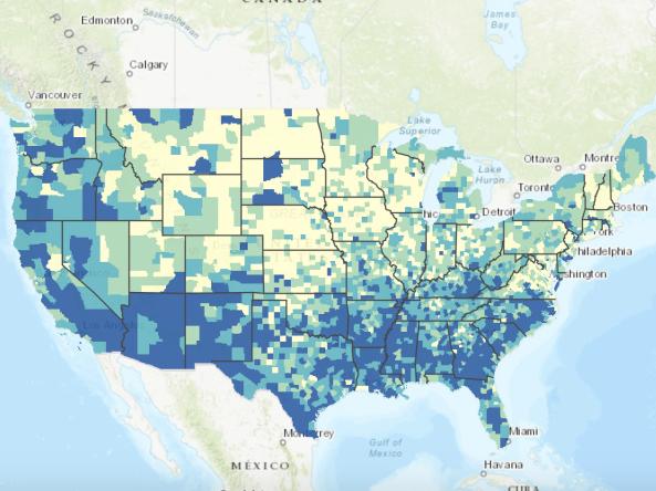
Social vulnerability refers to the resilience of communities when confronted by external stresses on human health, stresses such as natural or human-caused disasters, or disease outbreaks. Reducing social vulnerability can decrease both human suffering and economic loss. CDC's Social Vulnerability Index uses 15 U.S. census variables at tract level to help local officials identify communities that may need support in preparing for hazards or recovering from disaster.
The Geospatial Research, Analysis, and Services Program (GRASP) created and maintains CDC’s Social Vulnerability Index.
How To
How do I use the interactive map?
- Click the >> symbol in the upper left of the map to display the Map Details and Legend.
- Select a year from the dropdown menu to view data from that year.
- Click the Details tab to display Map Tips, which explain how to explore the map.
- Click the Map Legend tab to display and interact with the layers comprising the map for the selected year.
Access
Social Vulnerability Index (SVI) Website
SVI Interactive Map: View the SVI for the U.S. as an interactive map
Prepared County Maps: View prepared SVI maps by county
Data and Documentation Download: Download SVI documentation and data
Documentation
Data and Documentation Download: Download SVI documentation for each year
A Social Vulnerability Index for Disaster Management (PDF): Learn more about the development of the SVI