CoCoRaHS Condition Monitoring
Community Collaborative Rain, Hail, and Snow Network (CoCoRaHS)
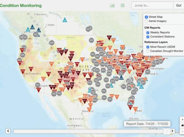
This condition monitoring map is a tool intended to depict local, community-level conditions and how recent weather and climate events have affected those communities. Volunteer observers provide weekly reports through the Community Collaborative Rain, Hail, and Snow (CoCoRaHS) network website. The web map spatially displays the reports and provides the current U.S. Drought Monitor map.
How To
The interactive web map allows users to view condition monitoring reports by clicking on the observer location. The observer location is represented by a dot of the same color as the level of wetness or dryness selected for that week’s condition monitoring report. A time slider at the bottom of the screen provides access to the reports in one week increments. Users can toggle between layers to view additional layers of precipitation data, the U.S. Drought Monitor map for the selected week, or geographic boundaries such as counties.
User Guide