Site Section
Data & Maps
CPC Regional Climate Maps
Associated Agencies
NOAA National Weather Service (NWS) Climate Prediction Center (CPC)
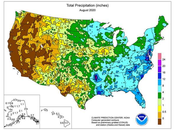
National Weather Service (NWS) Climate Prediction Center (CPC) generates Regional Climate Maps for the United States. These maps are available in weekly, one-, three-, and twelve-month maps depicting total precipitation, percent of normal precipitation, average temperature, maximum and minimum temperatures, and departures from normal.
How to
How to use this site:
- Scroll or use the menu to select a timescale
- Select a product to view the most current map
- To enlarge map, select “Click here for larger version” at the bottom of the map
- To save enlarged map, right-click map and select “Save Image As...”
Access
NWS Climate Prediction Center (CPC) Regional Climate Maps: view temperature and precipitation maps for the United States
Partner(s)

Representative Image