Site Section
Data & Maps
Integrated Water Portal
Associated Agencies
North Carolina State Climate Office (SCO)
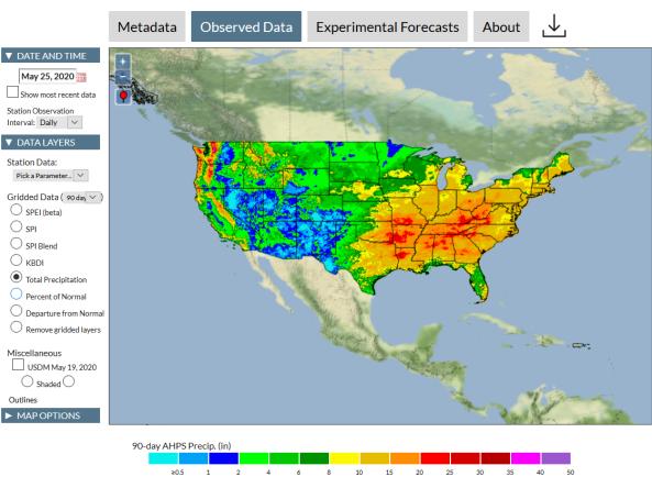
The Integrated Water Portal is a map-driven data exploration and visualization tool that brings together water data from several agencies and allows users to quickly explore regional and local water conditions, focused mostly on surface and near surface supplies. The integrated water portal is especially designed to support drought monitoring and forecasting needs.
The Integrated Water Portal is a product of the North Carolina State Climate Office (SCO).
How to
- Navigate to the Integrated Water Portal
- Use the tabs along the top of the map to select the desired layer types ("Observed Data" or "Experimental Forecasts")
- Use the menu to the left of the map to select the desired layers to explore and visualize
- To download images or data, click the download icon near the upper right corner of the map
Access
Documentation
To access Integrated Water Portal methodology, click the "About" tab located above the map and select "Methodology" from the menu options.
Partner(s)
Representative Image