Site Section
Data & Maps
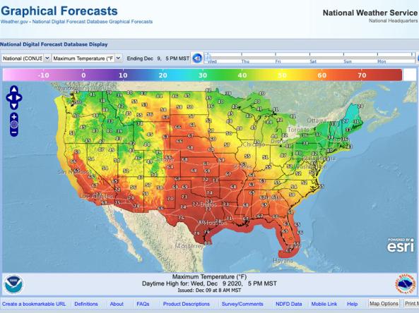
National Weather Service Graphical Forecast Interactive Map
Associated Agencies
National Oceanic and Atmospheric Administration's National Weather Service (NWS)
NWS Graphical Forecast is an interactive map that displays current and forecasted meteorological products including: Temperature, Precipitation, Probability of Precipitation, Weather, Hazards, Dew Point, Relative Humidity, Wind Speed, Wind Gusts, Wind Direction, and Sky Cover.
How to
How to use this site:
- Select geographic area and product (map will update automatically)
- Use the time scale to see forecast of products across the region
- Select “Map Options,” on bottom-right, to edit layers or map units
- Select “Print Map,” on bottom-right, to print map
- Select “NDFD Data” to download map data in GRIM2, Shapefile, XML, WFS or images
Access
NWS Graphical Forecast Interactive Map: view current and forecasted meteorological data for the United States
Graphical Forecast Interactive Map Data: download map data from NWS National Digital Forecast Database (NDFD)
Partner(s)
Representative Image