Site Section
Data & Maps
National Weather Service Heat Index Forecasts
Associated Agencies
NOAA / National Weather Service / National Centers for Environmental Prediction / Weather Prediction Center
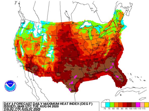
The National Weather Service (NWS) issues heat index forecasts from the medium-range forecast function of the Weather Prediction Center for days 3–7 during the period May to September. The suite of products is issued twice per day and includes daily maximum heat index, daily mean heat index, daily minimum heat index forecasts, and GIS formatted heat index forecasts.
How To
- Click on the maps to view heat index and probability forecasts.
- To download a map image, right click on the map and select "Save Image As."
- You can also view text files of the Heat Index Probability Forecasts for the Eastern U.S. and Western U.S.
- To download GIS Shapefiles, visit the GIS formatted heat index forecasts page.
Documentation


Representative Image