Regional Mesonet Program (RMP) Potential Evapotranspiration Maps
Regional Mesonet Program (RMP), hosted by the Midwestern Regional Climate Center
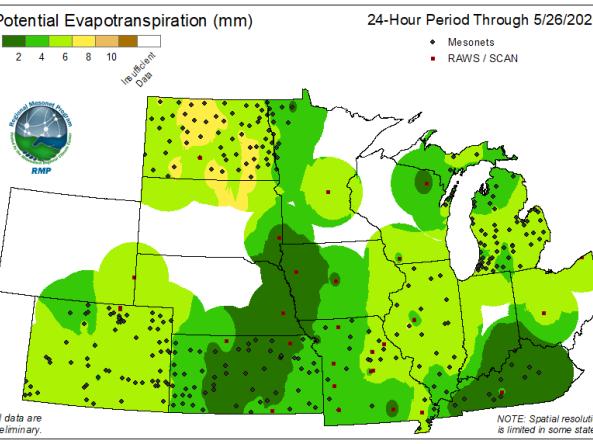
The Regional Mesonet Program (RMP) produces Potential Evapotranspiration (PET) maps at 24-hour and 7-day intervals for the Midwest region. Using the Penman-Monteith algorithms to calculate PET, parameters gathered at many mesonet sites such as incoming solar radiation, winds, humidity, and temperature can help provide an indicator for how much moisture could evaporate under ideal conditions. Additional networks are also used to fill in data gaps between mesonets here as well.
RMP is a collaboration of multiple states and mesonet groups. It offers the opportunity to see the regional value of mesonet data when various networks are brought together.
The Midwestern Regional Climate Center (MRCC) hosts operational product maps from various mesonet groups around its region, which are updated daily. Mesonets are a collection of observation stations that gather information about the environment such as atmospheric, soil, and moisture conditions (see the Summary Table of Midwest Mesonets on the Data Networks page).
How to
- Use the banner on the left to select interval period ("24-hour" or "7-day")
- Click the "Potential Evapotranspiration (PET)" option to view the map
- Use the dropdowns on the left to select:
- Interval period ("24-hour" or "7-day")
- Desired product ("Potential Evapotranspiration (PET)"
- Date of interest