Regional Mesonet Program (RMP) Soil Temperature Maps
Regional Mesonet Program (RMP), hosted by the Midwestern Regional Climate Center
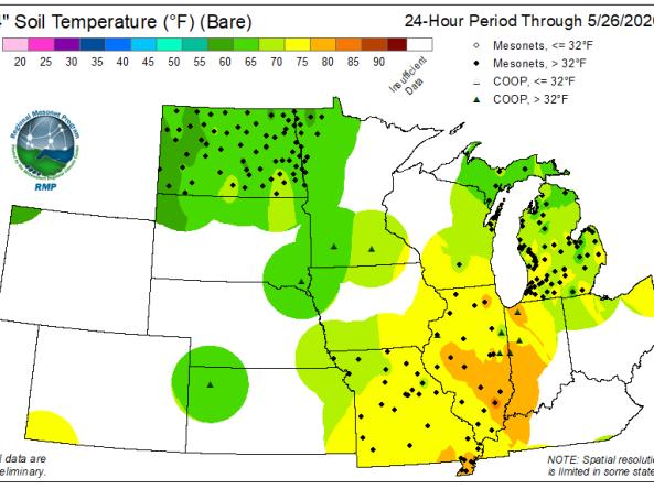
The Regional Mesonet Program (RMP) produces Soil Temperature maps at 2-inch and 4-inch depth for both bare soil and sod for the Midwest region.
Begun in 2013, the RMP piloted this mosaic-style concept with soil temperature data from around the region. Soil temperature is not a common parameter measured at most national data collection networks, so this provided a suite of products that were unique, and available only when data from multiple mesonets are combined. Soil temperature observations, however, are gathered at varying depths and beneath different types of surface cover, depending upon the needs and interests of the mesonet. The most common soil temperature depth is 4”, but some stations and networks also measure at 2” depth. The two conventional surface cover types are either sod or bare soil. Not every mesonet (or station within a mesonet) collect both of these depths and cover types. Therefore, additional data from other networks (e.g., Climate Reference Network) are added to improve spatial coherency where there are gaps between mesonets.
RMP is a collaboration of multiple states and mesonet groups. It offers the opportunity to see the regional value of mesonet data when various networks are brought together.
The Midwestern Regional Climate Center (MRCC) hosts operational product maps from various mesonet groups around its region, which are updated daily. Mesonets are a collection of observation stations that gather information about the environment such as atmospheric, soil, and moisture conditions (see the Summary Table of Midwest Mesonets on the Data Networks page).
How to
- Use the banner on the left to select interval period ("24-hour" or "7-day")
- Select the soil type and depth desired
Archived Soil Temperature maps
- Use the dropdowns on the left to select:
- Interval period ("24-hour" or "7-day")
- Desired soil type and depth
- Date of interest