ACF River Basin Now Part of Expanded Southeast DEWS
The U.S. Southeast region is increasingly experiencing record-breaking droughts that can develop rapidly. Recognizing a need to improve drought early warning across the full geographic footprint of the Southeast, and in response to requests from regional stakeholders, the National Integrated Drought Information System (NIDIS) developed a Southeast Drought Early Warning System (DEWS) in 2020.
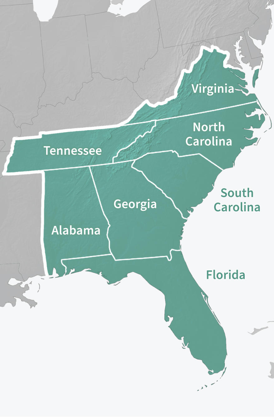
This Southeast DEWS builds on the partnerships and successes from the Apalachicola-Chattahoochee-Flint River Basin and Coastal Carolinas DEWS, while expanding to include the full geographic footprint of Florida, Alabama, Georgia, South Carolina, North Carolina, Virginia, and Tennessee.
About the Previous ACF River Basin DEWS
The Apalachicola-Chattahoochee-Flint (ACF) River Basin covers over 12 million acres of watershed across Georgia, Alabama, and Florida. With its headwaters in Georgia, the ACF Basin terminates in the Apalachicola Bay along the coast of Florida’s panhandle. Water in the ACF Basin meets a range of needs, including, but not limited to, municipal and industrial water supply, agricultural irrigation, hydroelectric generation and thermoelectric cooling, and environmental and instream flows. Metropolitan Atlanta, with a population of more than 5 million, relies upon Lake Lanier and the Chattahoochee River for approximately 70% of its water supply.
In December 2009, recurring droughts led NIDIS to select the ACF Basin as a high priority for developing a DEWS in the Southeastern United States, largely because of the breadth and complexity of the Basin’s ongoing water management challenges.
Key Accomplishments of the ACF River Basin DEWS (2009–2020)
- Expanded dissemination and use of drought information through a long-standing ACF Drought and Water Monthly Webinar Series. These webinars have become important mechanisms to communicate climate, water, and drought conditions in the ACF, and have been operating on a monthly basis since 2011. Partner organizations that contribute regularly to the webinars include the USGS South Atlantic Water Science Center, National Weather Service Southeast River Forecast Center, the U.S. Army Corp of Engineers Mobile District, the Florida Climate Center, and Alabama’s Office of Water Resources. Register for 2021 ACF webinars here and access ACF monthly drought updates through our Drought Status Update archive.
- Expanded access and utilization of drought information in the ACF by setting up the need and identifying components for a new ACF River Basin Drought & Water Dashboard. This new web-based application allows users to monitor drought situations in real time and facilitate data-driven decision-making. More information on the ACF Drought & Water Dashboard, which was launched in January 2022, can be found here.
- Improved understanding of drought and climate processes in the ACF through the development of educational modules and fact sheets that explain key technical content, concepts, and processes. Examples include ACF Drought Indicators and Management, and Southeast Climate Variability and Forecasts. Modules and factsheets can be found here.
- Advanced research to better plan for future droughts in the ACF through projects supported by NIDIS and other partners. These projects included studying impacts of climate variability on drought, adaptation planning for the ACF River Basin, incorporating climate-change scenario simulations to analyze future drought characteristics, defining groundwater levels as a drought indicator, and developing effective drought management policies for the ACF River Basin to help resolve tri-state water conflicts.
- Developed a Sustainable Water Management Plan (SWMP) led by the ACF Stakeholders, which represents the first water management plan for the entire ACF Basin.
Looking for Resources from the ACF River Basin?
You can still find past documents and web resources on Drought.gov. Just filter by "ACF River Basin" on our document archive.
Or, visit the new ACF River Basin Drought & Water Dashboard for up-to-date current conditions, outlooks and forecasts, drought impacts, and historical drought information.
For more information on the previous ACF River Basin DEWS or the newly expanded Southeast DEWS, please contact Meredith Muth (meredith.f.muth@noaa.gov).