No changes to drought status, despite below normal precipitation last week.
For more details, see the Northeast Drought Early Warning System Dashboard.
Key Points
- Extreme Drought (D3) remained limited to southwest Maine and southeast New Hampshire.
- Severe Drought (D2) remained in coastal Maine, southeast New Hampshire, southeast Massachusetts, southeast Rhode Island and small portions of western and northern New York.
- Moderate Drought (D1) and Abnormally Dry (D0) areas saw little change.
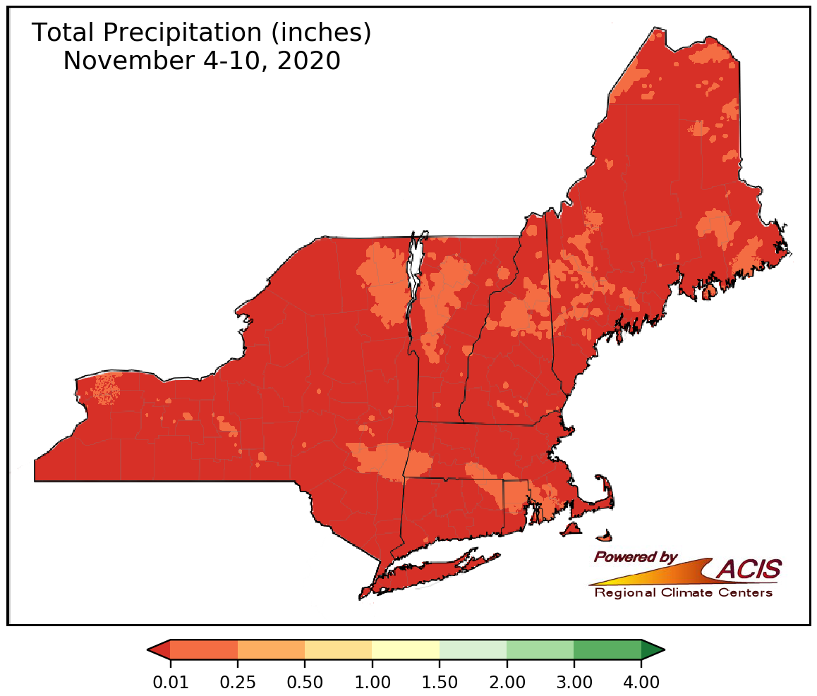
- From Nov. 4-10 there was little to no precipitation across the Northeast resulting in no changes in the drought status for the region.
U.S. Drought Monitor Conditions: Northeast |
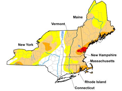
U.S. Drought Monitor map of the Northeast. Valid November 10, 2020.
State Reported Impacts
Drought Condition Monitoring Observer Reports (National Drought Mitigation Center): https://www.arcgis.com/apps/MapSeries/index.html?appid=25e1be8e6bfe4f2aa9bd3ece9beb226b
Connecticut
5 November - Hartford County:
“I have three wells, and the water table has fallen below even my deepest well (600 feet), I no longer have any household water. They are empty and no longer recovering. Due to soft bedrock in my area, hydrofracking is considered too risky (well collapse) and it is uncertain whether drilling a fourth well will produce any additional benefit. I have very few long-term options for obtaining water.”
New York
12 November - Wayne County:
“Rains are not yet recharging wells.”
Additional Reports can be found on:
Drought Tweets (National Drought Mitigation Center)
Current Conditions
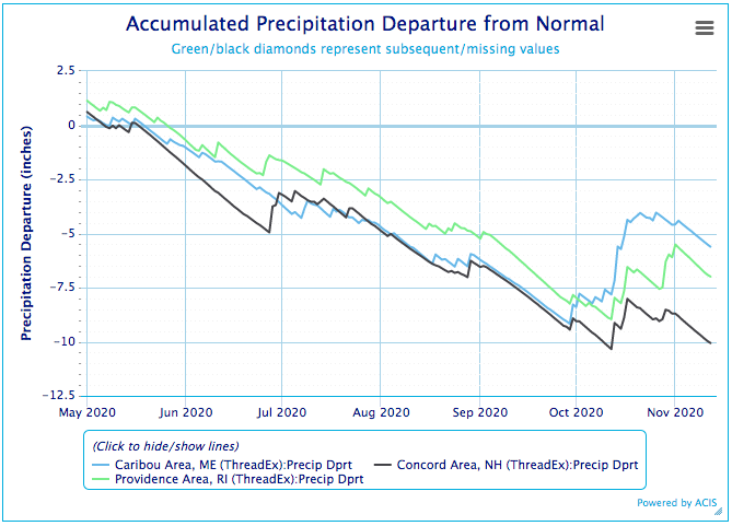
Accumulated Precipitation Departure From Normal (includes precipitation for Nov. 5)
- October rainfall had reversed the downward trend of precipitation departure from normal, but the dry trend resumed in November.
Total Precipitation From November 4-10, 2020
- Little to no precipitation fell on the Northeast in the last week.
Outlooks
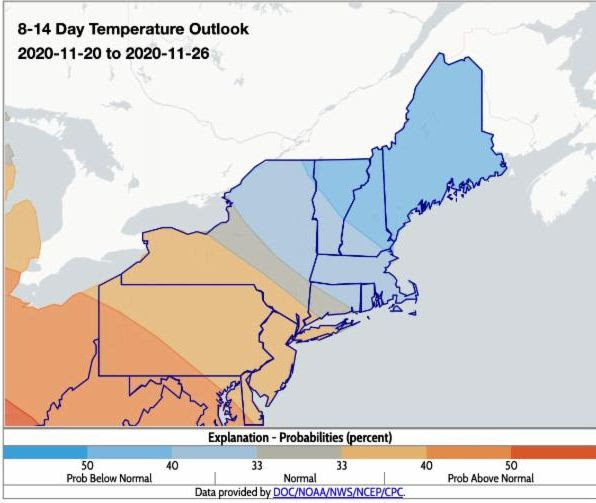
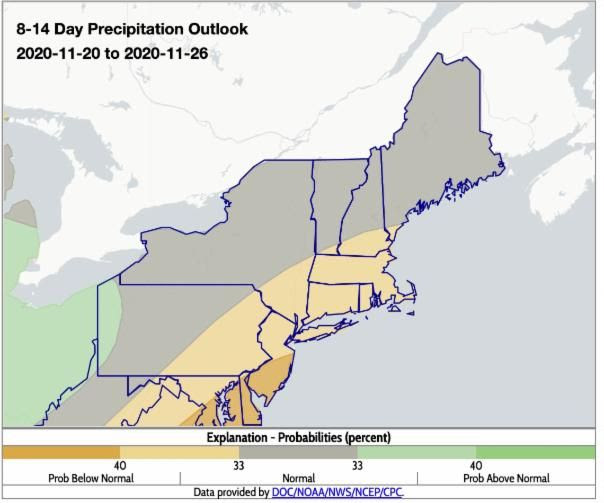
- The 8-14 day maps indicate below- or near-normal temperatures are favored for most areas, except western, central, and far southeastern New York where above-normal temperatures are favored. Below- or near-normal precipitation is predicted for the entire region.
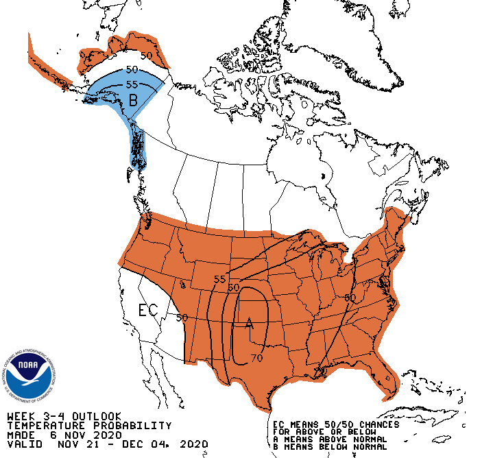
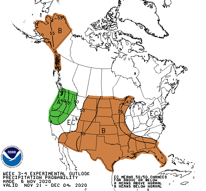
- The 3-4 week outlook favors above-normal temperatures and equal chances for above- or below-normal precipitation for the Northeast.
Temperature Outlook 8-14 Day
Precipitation Outlook 8-14 Day
Temperature Outlook Week 3-4
Precipitation Outlook Week 3-4
Current CPC Outlooks: https://www.cpc.ncep.noaa.gov/
Additional Resources
- Northeast DEWS Dashboard
- NOAA Regional Climate Services
- Your local National Weather Service office
- NOAA Regional Climate Services Monthly Webinar Series (November 19 next webinar)
- USDA Northeast Climate Hub
- USGS/New England and New York Water Science Centers
Contacts for More Information
Sylvia Reeves
Regional Drought Information Coordinator (Northeast DEWS)
NOAA/CIRES/National Integrated Drought Information System (NIDIS)
Email: sylvia.reeves@noaa.gov
Ellen L. Mecray
Regional Climate Services Director, Eastern Region
NOAA/NESDIS/National Centers for Environmental Information
Email: Ellen.L.Mecray@noaa.gov
Sylvia Reeves
NOAA/National Integrated Drought Information System (NIDIS)
Samantha Borisoff, Jessica Spaccio, Keith Eggleston, Art DeGaetano
Northeast Regional Climate Center
Ellen Mecray
Regional Climate Services Director, Eastern Region, NOAA
David Hollinger and Maria Janowiak
USDA Climate Hubs
Gardner Bent
USGS/New England Water Science Center
In partnership with National Weather Service Offices of the Northeast and State Climate Offices of the Northeast.


