High-Resolution Western Drought Forecasts Could Be on the Horizon
A new computer modeling technique developed by scientists at the National Center for Atmospheric Research (NCAR) offers the potential to generate months-ahead summertime drought forecasts across the Western United States with the capability of differentiating between dry conditions at locations just a couple of miles apart.
The technique uses statistical methods and machine learning to analyze key drought indicators during the winter and spring and correlate them with the likelihood of dryness throughout the landscape the following summer. The scientists say this approach, if adapted for use by forecasters, could provide important information for such priorities as management of water resources, wildland fire and fuels, and agriculture.
“This approach forecasts drought conditions before they have the largest impact,” said NCAR scientist Ronnie Abolafia-Rosenzweig, the lead author of a new paper describing the technique. “It gives managers an additional tool that they can use to prepare and guide the decisions they are making.”
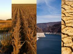
Abolafia-Rosenzweig and his co-authors found that predictions issued one to three months in advance could correctly identify the occurrence of summer drought in about 81%–94% of cases at a resolution of 4 kilometers (2.5 miles) across the rugged and often parched western third of the United States. The predictions proved most accurate in regions of persistent drought, showing how upcoming dry conditions may vary from a cultivated field to a nearby mountainside or forested area. In regions where dry spells were punctuated by periods of heavy summer precipitation, however, the predictions proved less accurate.
The scientists detailed their findings in a recent article in Water Resources Research, a journal published by the American Geophysical Union. The work was supported by the National Integrated Drought Information System (NIDIS) through the NOAA MAPP program, as well as the U.S. National Science Foundation, which is NCAR’s sponsor, and the U.S. Geological Survey (USGS) Water Mission Area's Integrated Water Prediction Program.
Strengthening Societal Resilience
Droughts can have devastating health and economic impacts, costing the United States at least $249 billion since 1980 and setting the stage for widespread fires. In the West, the period from 2000–2021 was the driest 22-year stretch since at least the year 800, according to tree ring data. In 2021 alone, the drought and associated heat waves led to hundreds of deaths in the region.
To strengthen societal resilience, scientists are working to improve computer modeling techniques that produce months-ahead predictions of drought. Current drought forecasts, however, have a relatively coarse resolution of, at best, about 10 kilometers, which does not adequately capture the varying degrees of drying across different landscape features in the West.
But a new dataset that NCAR scientists recently produced in collaboration with the U.S. Geological Survey helped open the way for more detailed drought forecasts. The dataset is named CONUS404 because it contains simulations of hydrological and climate conditions at 4-kilometer resolution across the continental United States (or CONUS) over the past 40-plus years. Abolafia-Rosenzweig and his co-authors also drew on an equally high-resolution U.S. Department of Agriculture dataset, known as PRISM (Parameter elevation Regression on Independent Slopes Model) for meteorological observations.
These datasets enabled the scientists to identify complex relationships, at a 4-kilometer resolution, between climate and drought conditions in late fall and winter and the extent of drying during the following summer. To identify these relationships, they used machine learning techniques that trained specialized statistical models.
The scientists focused on pre-summer climate variables such as temperature, precipitation, and humidity, as well as distant ocean-atmosphere patterns such as the Pacific Multidecadal Oscillation that have far-reaching effects on climate. They found that commonly used drought measures, the Palmer Drought Severity Index and soil moisture percentiles, have strong persistence from winter and spring into the summer, making pre-summer drought severity an especially important predictor of summer drought conditions.
Abolafia-Rosenzweig said the drought forecasting method can augment a fire prediction technique that he and his co-authors had developed last year. Combining the drought and fire models offers the potential for a very detailed look at fire hazard across the West.
“The West is in a very unique period in terms of both drought and fire with records being broken that go back thousands of years,” he said. “The climate projections are showing drought conditions will continue to intensify in the future. Having tools that can better inform management is becoming increasingly important.”
Read the article in Water Resources Research: High Resolution Forecasting of Summer Drought in the Western United States.
This news story was originally published by NCAR.


