Drought Early Warning Activities
Each regional drought early warning system (DEWS) focuses on improving early warning capacity for and resilience to drought in that region, including examining the role of extreme weather events and climate variability in drought.
NIDIS has developed regional drought early warning systems (DEWS) throughout the United States, where local networks of researchers, resource managers, policymakers, the private sector, academics, and other stakeholders share information and actions to help their communities cope with drought.
A DEWS coordinates this network of key regional partners so that decision makers and citizens can systematically approach drought monitoring and forecasting integration when planning and preparing for drought. Regional DEWS encourage innovation by integrating new, locally relevant drought information, and supporting the introduction and testing of technologies that detect and communicate drought risks and warnings.
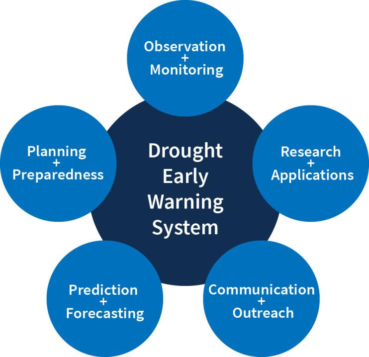
Regional DEWS activities focus on five key areas for drought early warning (DEWS components): observation and monitoring, prediction and forecasting, planning and preparedness, communication and outreach, and interdisciplinary research and applications.

Drought Early Warning Activities
The table below shows ongoing activities related to drought early warning across the United States. Each activity falls into one or more of the five key areas of drought early warning systems (DEWS components): observation and monitoring, planning and preparedness, prediction and forecasting, communication and outreach, and interdisciplinary research and applications.
This project sought to develop drought adaptation plans for the Flandreau Santee Tribe and the Standing Rock Sioux Tribe. This project is unique in that it is sponsored in part by the…
2017
2018
This project focused on developing drought adaptation plans for the Rosebud Sioux Tribe and the Oglala Sioux Tribe. This project is unique in that it is being sponsored in part by…
2017
2018
Assessments following the 2016 drought in New York and New England broadly identified data gaps related to soil moisture, streamflow, and groundwater levels. To address these shortcomings, this…
2019
2021
The Indiana State Climate Office is in the process of developing an enhanced flash drought risk tool that can be utilized by government agencies, communicators, and the public to monitor…
2019
2022
As part of the U.S. Geological Survey Fisheries program, ecological flows (or the relationships between quality, quantity, and timing of water flows and ecological response of aquatic biota and…
2020

