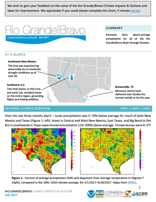
Summary of current conditions, climate outlook, and fire potential for the Rio Grande-Bravo region of the United States.

The ACF DEWS Strategic Plan (Plan) outlines priority tasks and activities across the region to build drought early warning capacity and resilience. It includes a list of current partners, outcomes, and key milestones. This Plan is a “living document” to which additional actions and partners may be added as needed.
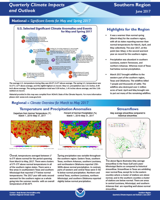
Quarterly Climate Impacts and Outlook for the Southern Region for March – May 2017. Dated June 2017.
It was a warmer than normal spring (March-May) for the southern region, with all six states reporting warmer than normal temperatures for March, April, and May collectively. The year 2017, at this point (Jan–May), is the second warmest year on record for the southern region.
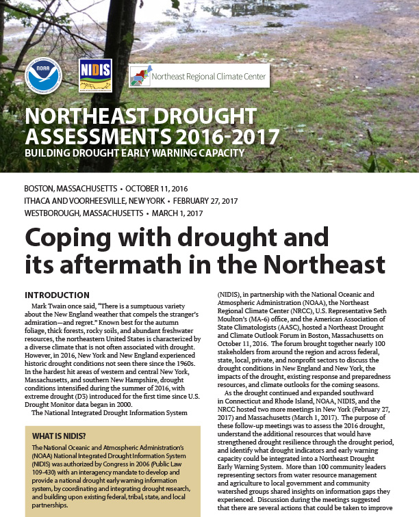
The National Integrated Drought Information System (NIDIS), in partnership with the National Oceanic and Atmospheric Administration (NOAA), the Northeast Regional Climate Center (NRCC), and the American Association of State Climatologists (AASC), hosted three Northeast Drought and Climate Outlook Forums as record-breaking drought expanded in the Northeast in 2016-2017. Participants included stakeholders from around the region and across federal, state, local, private, and nonprofit sectors.

Quarterly Climate Impacts and Outlook for Alaska and Northwestern Canada for March – May 2017; outlook for July – September 2017. Dated June 2017.

Quarterly Climate Impacts and Outlook for the Missouri River Basin March – May 2017. Dated June 2017.
Overall, it was a warm spring with each state in the above to much above average range. Colorado and Wyoming were ranked highest in the region as the 8th warmest on record. Spring precipitation was varied with Missouri and Kansas ranking as the top 4th and 5th wettest, respectively, and North Dakota ranking as the 9th driest.
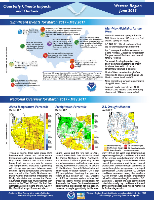
Quarterly Climate Impacts and Outlook for the Western Region for March – May 2017. Dated June 2017.
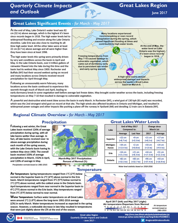
Quarterly Climate Impacts and Outlook for the Great Lakes Region for March – May 2017. Dated June 2017.
At the end of May, Lake Ontario’s water level was 82 cm (32 in) above average, which is the highest it’s been since records began in 1918. The high water levels led to widespread flooding and erosion along the Lake Ontario shoreline. Lake Erie was also close to reaching its all-time high water level. All the other lakes were at least 22 cm (8.7 in) above average and all were higher than they have been since at least 1998.
The 2017–2018 Intermountain West (IMW) Drought Early Warning System (DEWS) Strategic Plan outlines priority tasks and activities across the region to build drought early warning capacity and resilience. It includes a list of current partners, outcomes, and key milestones. This Plan is a “living document” to which additional actions and partners may be added as needed.

Quarterly Climate Impacts and Outlook for the Southeast Region for March – May 2017. Dated June 2017.