Drought Expected to Continue Through Fall; Impacts Could Last Multiple Years.
Key Points
- The drought that began in March continues across much of the Pacific Northwest. So far precipitation in August has been below normal in the Idaho Panhandle and across much of southern Washington and Oregon.
- 94.2% of the Pacific Northwest Drought Early Warning System (DEWS) region is in drought, with 59.7% experiencing Extreme (D3) or Exceptional (D4) Drought conditions.
- After two record-breaking heatwaves and above normal temperatures this summer, the region has seen some relief with cooler temperatures recently.
- Oregon, Washington, and Idaho governors joined seven other western governors in signing a letter to President Biden requesting a FEMA disaster declaration for their states based on the drought conditions and impacts. Impacts cited included those to agriculture, as well as the downstream impacts on the security of food, fiber, and energy production, drinking water, recreational economies, and wildfire.
- The latest Climate Prediction Center precipitation and temperature outlooks do not indicate much relief in the next three months. From September to November, there is a greater chance of above-normal temperatures for much of the Northwest, and most of the region has equal chances for below-, above-, and near-normal precipitation.
- Low soil moisture may impact the planting and germination of next year’s crop of winter wheat.
- Impacts to crops, rangeland, surface and groundwater, freshwater ecosystems, and wildfire risk are likely to continue and worsen.
- Given the impacts to reservoir levels, reliance on aquifers due to low surface water base flows, and lack of natural recharge, the hydrological impacts of drought could last multiple years. Recharge of groundwater systems often takes more than two years even with normal to above-normal precipitation.
Current U.S. Drought Monitor map for the Pacific Northwest, as of August 17, 2021. The U.S. Drought Monitor (USDM) is updated each Thursday to show the location and intensity of drought across the country. Drought categories show experts’ assessments of conditions related to dryness and drought including observations of how much water is available in streams, lakes, and soils compared to usual for the same time of year
U.S. Drought Monitor Categories
Current U.S. Drought Monitor map for the Pacific Northwest, as of August 17, 2021. The U.S. Drought Monitor (USDM) is updated each Thursday to show the location and intensity of drought across the country. Drought categories show experts’ assessments of conditions related to dryness and drought including observations of how much water is available in streams, lakes, and soils compared to usual for the same time of year
Current Conditions
- 94.2% of the Pacific Northwest DEWS region is in drought, with 59.7% experiencing Extreme (D3) or Exceptional (D4) Drought conditions.
- March through July precipitation for the majority of the region was much below normal, with record driest in eastern Washington, northeastern Oregon, and northern Idaho compared to the period from 1895–2010 (Figure 1). July precipitation for the Northwest was about 45% of normal, which is equivalent to a deficit of 0.35 inches (Climate Toolbox Climate Mapper).
- Precipitation in August has been below normal in the Idaho Panhandle and across much of southern Washington and Oregon. Above-normal August precipitation-to-date has reduced the number of SNOTEL sites in southern Idaho setting new records for low precipitation and has significantly reduced the short-term hydrologic drought across the state. The exception to this is the Bruneau River and Owyhee River (which flows into eastern Oregon).
- The summer of 2021 in the Pacific Northwest so far has featured much warmer than normal temperatures (Figure 2), especially east of the Cascade Mountain crest across northern Idaho. Averaged over the Northwest, July was 5.1°F above normal (1991–2020); the previous record was +3.8°F in 2007. The region has generally seen cooler temperatures over the past week.
- Many reservoir water levels are below to well below average across the region in both U.S. Bureau of Reclamation and U.S. Army Corps of Engineers systems. Klamath Basin reservoirs continue to measure below-average water levels. Overall water supply conditions are very low across Idaho with reservoirs still being rapidly depleted of storage water. Carryover will be average in all reservoirs, with little or no carryover in the Boise River, Mountain Home, Owyhee River, Big Wood, Little Wood, Big Lost, Oakley, and Salmon Falls reservoir systems. Only Bear Lake is likely to have close to a full allocation in storage for next year at the end of the season, because Bear Lake has storage capacity for multiple years.
Figure 1. March–July 2021 Precipitation Percentile Rankings

Figure 2. March–July 2021 Mean Temperature Percentile Rankings

Drought Impacts
- Oregon, Washington, and Idaho governors joined seven other western governors in signing a letter to President Biden requesting a FEMA disaster declaration for their states based on the drought conditions and impacts. Impacts cited included those to agriculture, as well as the downstream impacts on the security of food, fiber, and energy production, drinking water, recreational economies, and wildfire.
- Thus far in 2021, 22 Oregon counties have received Executive Orders issuing drought declarations. One additional drought declaration request has been received from Yamhill County. Twenty counties in Idaho have drought declarations as of August 4, 2021. The Washington Department of Ecology issued a drought declaration (July 14, 2021) nearly statewide except for portions of Snohomish, King, and Pierce counties that include Everett, Seattle, and Tacoma.
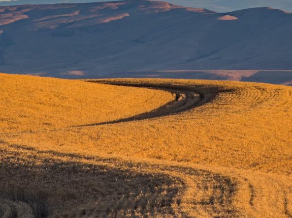
- Winter wheat harvests are projected to be down 21% in Idaho, 31% in Oregon, and 44% in Washington from last year, with spring wheat down 23% in Idaho and 42% in Washington. Barley harvest is projected to be down 36% in Idaho and 52% in Washington from last year (USDA National Agricultural Statistics Service). The majority of wheat in Washington is dry-farmed (not irrigated), and some areas of the state experienced complete crop failure according to the Washington Association of Wheat Growers.
- While apple production (mostly irrigated) is projected to be up from last year by 7% in Washington and 9% in Oregon, huckleberry and potato harvests are likely affected negatively, and Christmas tree farms are reporting death of new trees even with irrigation. The heat wave and dry conditions have impacted fruit trees, trees, and landscape plants in addition to agricultural crops.
- Dry conditions continue to affect hay and forage, forcing the early sale of cattle. Pasture and crop conditions continue to deteriorate. In northeastern Oregon and other areas, 2022 crop planting was delayed due to dry conditions (Figure 3; USDA NASS)
- An unusual impact called “precocious sprouting” has been noted in spring canola, where sprouting of seed within the pod of yet unharvested canola has been happening in spite of hot and dry conditions. This sprouting has been observed in fields in Umatilla County, Oregon and in Asotin, Garfield, Lincoln, Spokane, and Whitman Counties in Washington. It is likely that it could be in other areas of Idaho, Oregon, or Washington as well (OSU Extension).
- More than 1 million acres burned in wildfires in Washington and Oregon by August 15, 2021, compared with about 52,500 acres by the same time in 2020, according to the Northwest Interagency Coordination Center. As of August 18, 2021, 115,971 acres of land have burned across the state of Idaho. The 20-year average is 20,049 acres burned in one year (Idaho Department of Lands). Numerous large fires continue to burn across the region with 22 active large fires in Idaho and 21 each in Washington and Oregon (Figure 4; InciWeb).
- Mortality of juvenile salmon, steelhead, sturgeon, and trout in the Klamath Basin as a result of low water flows, high water temperatures, and associated disease has been considerable, reportedly exceeding 90% in some locations.
Figure 3. USDA Topsoil Moisture for the Week Ending August 22, 2021

Figure 4. Active Large Fires Across the Pacific Northwest

If you are seeing additional impacts or different impacts of the drought where you live, please let us know!
Outlook and Potential Impacts
- The outlook for the Labor Day Weekend is for dry but somewhat seasonal weather. Outlooks favor a dry and mild September, then trending to more seasonal conditions through the Fall months.
- The official September-October-November outlook from the Climate Prediction Center shows a chance of above-normal temperatures (Figure 5) for Oregon, the southernmost part of Washington, and most of Idaho, with equal chances of above-, below-, or near-normal temperatures in Washington and the Idaho panhandle. The whole region has equal chances of above-, below-, or near-normal precipitation (Figure 6), except the northwest corner of Oregon and western Washington, which have a greater chance of above-normal precipitation, and the southwest corner of Idaho, which has a greater chance of below-normal precipitation.
- The Significant Wildland Fire Potential Outlook shows elevated wildfire potential through September for most of the region except southeast Oregon and southeast Idaho.
- The Climate Prediction Center's Seasonal Drought Outlook (through November 30) indicates persistent drought conditions across the region with the exception of the Olympic Peninsula and northwest Washington west of the Cascades.
- The Climate Prediction Center's ENSO Alert System indicates that ENSO-neutral is favored for the Northern Hemisphere summer through September (6% chance), with La Niña possibly emerging during the August–October season and lasting through the 2021–22 winter (~70% chance during November–January). The emergence of a La Niña in September and November could lead to a wetter than normal winter though there are regional differences in this pattern. Short of a robust snowpack, the Northwest is likely to experience lingering moisture deficits into next year.
- Low soil moisture may impact the planting and germination of next year’s crop of winter wheat.
- Impacts to crops, rangeland, surface and groundwater, freshwater ecosystems, and wildfire risk are likely to continue and worsen.
- Given the impacts to reservoir levels, reliance on aquifers due to low surface water base flows, and lack of natural recharge, the hydrological impacts of drought could last multiple years. Recharge of groundwater systems often takes more than two years even with normal to above-normal precipitation.
Figure 5. Three-Month Temperature Outlook

Figure 6. Three-Month Precipitation Outlook

For More Information
- NIDIS and its partners will issue future updates as conditions evolve.
- More local information is available from the following resources:
- For additional regional drought and wildfire resource information, see 2021 Pacific Northwest Drought Resources.
- Watch the webinar recording and read a summary of the Pacific Northwest August Drought & Climate Outlook webinar.
- Federal drought declarations are available from the U.S. Department of Agriculture's Farm Service Agency.
- Read the National Weather Service's Western U.S. Fall Hazards Outlook.
Prepared By
Britt Parker
NOAA National Integrated Drought Information System
Karin Bumbaco
Office of the Washington State Climatologist
David Hoekema
Idaho Department of Water Resources
Ryan Andrews
Oregon Department of Water Resources
Larry O’Neill
Oregon Climate Service
Scott Oviatt
USDA Natural Resources Conservation Service
Holly Prendeville
USDA Northwest Climate Hub
This drought status update is issued in partnership with the states of Oregon, Washington, and Idaho, the USDA Northwest Climate Hub, the USDA Natural Resources Conservation Service, and the Oregon Climate Change Research Institute to communicate a potential area of concern for drought expansion and/or development within the Pacific Northwest based on recent conditions and the upcoming forecast. NIDIS and its partners will issue future drought status updates as conditions evolve.


