U.S. flag

An official website of the United States government

NEWS ARCHIVE

Browse news articles

Published Date Between
Search Results(153)
Published on

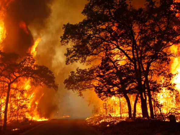
Last year, extreme heat and extensive drought led to a series of large wildfires across the western United States. To help address growing wildfire-related challenges, the U.S. Geological Survey (USGS) has rolled out a new Wildland Fire Science Strategy that lays out the critical needs for wildfire research over the next five years. Released in February, this strategy can be used to better understand the balance between fire’s benefits and its detrimental impacts.

Published on

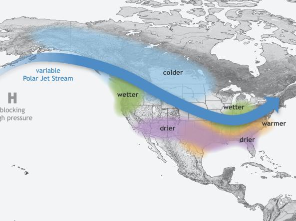
El Niño and La Niña events show a wide range of durations over the historical record, but whether event duration can be predicted has remained largely unknown. Since longer-lived, multi-year El Niño and La Niña events could extend their climate and socioeconomic impacts, it’s important to have accurate predictions of their durations with the longest lead times possible. A new study published in the Journal of Climate uses the Community Earth System Model, version 1 (CESM1) to show that event duration is highly predictable.

Published on

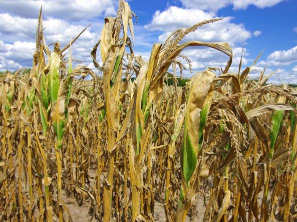
Land-surface models (LSMs) play a key role in the monitoring and forecasting of drought. A new study published in the Journal of Hydrometeorology builds on previous research to evaluate the impact of assimilating Leaf Area Index (LAI) observations on the Noah-MP LSM's ability to estimate agricultural drought. 

Published on

Flash drought has serious real-world implications. The 2017 Northern Plains flash drought resulted in fires that burned 4.8 million acres and U.S. agricultural losses in excess of $2.6 billion dollars. Neither the drought’s swift onset nor its severity were forecasted. Episodes like this have sparked intense interest in flash drought in both the research community and the end user/applications community. Clear conceptualization of flash drought is important to both communities as there are differing understandings and confusion on what flash drought is and how it differs from other droughts. To address this need, NIDIS held a virtual workshop in December 2020 that convened researchers and end users to begin developing a shared understanding/definition of flash drought, and to identify research and tools needed to improve flash drought early warning.
 

Published on

NOAA’s National Integrated Drought Information System (NIDIS) has launched the redesigned U.S. Drought Portal (www.drought.gov) to better serve stakeholders, decision makers, the media, and the public. The new website features updated content and new interactive architecture designed to provide actionable, shareable information and easy-to-understand graphics describing current drought conditions and forecasts by city, county, state, zip code, and at watershed to global scales. The Drought Portal also aggregates and presents drought impact data for economic sectors such as agriculture, energy, water utilities, and tourism and recreation using interactive maps and data that don’t exist anywhere else

Published on

This series of maps shows a recap of drought across the United States in 2020, covering U.S. Drought Monitor category changes, precipitation and temperature conditions, streamflow and groundwater levels, wildfire, evaporative demand, snow drought, and more.

Published on

Since the start of the 21st century, California and Nevada have suffered extreme wildland fires and droughts that have caused devastating impacts to ecosystems and society. A common feature of these events has been very high evaporative demand—the “thirst” of the atmosphere—which has largely been driven by increased air temperatures caused by anthropogenic climate change. According to new research funded by NIDIS and the California-Nevada Applications Program (CNAP), a NOAA Regional Integrated Sciences and Assessment (RISA) team, climate change and a “thirsty atmosphere” will bring even more extreme wildfire danger and multi-year droughts to Nevada and California by the end of the next century. The research was led by the Desert Research Institute and Western Regional Climate Center, with co-authors from CNAP and in collaboration with University of California, Merced.

Published on

NIDIS just released its inaugural Tribal Drought Engagement Strategy, which presents guiding principles of tribal engagement, as well as key outcomes and tribal engagement activities for NIDIS and partners to implement in 2021 and beyond. This Strategy was developed by engaging with tribal nations within the Missouri River Basin and Midwest Drought Early Warning Systems (DEWS); however, the principles, as well as many of the activities, extend beyond these two regions.

Published on

Severe droughts are a devastating climate event and are considered one of the costliest natural disasters in the United States. With droughts impacting both ecological and economic sectors, improving the capability to predict the evolution of drought and its severity and frequency more accurately and reliably is crucial for early drought warning and mitigation. There have been considerable efforts toward understanding the mechanisms and predictability of drought. However, the current level of skill in forecasting drought onset, development, and demise is limited. To address this need, NIDIS funded a study through NOAA’s Climate Program Office Modeling, Analysis, Predictions, and Projections (MAPP) Program.

Published on

NOAA’s National Integrated Drought Information System (NIDIS) Program is announcing five new 2-year projects in Fiscal Year 2020 (FY20), through a multi-program collaboration, that aim to improve our understanding and use of drought indicators, thresholds and triggers, and drought impact reporting to inform decision-making to prepare for and respond to drought. The competitively selected projects total $2,776,805, including $2,541,397 in grants and $200,000 in other awards.