U.S. flag

An official website of the United States government

NEWS ARCHIVE

Browse news articles

Published Date Between
Search Results(154)
Published on

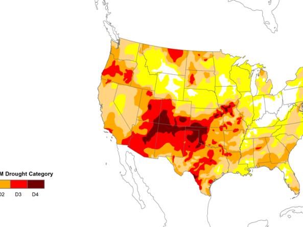
Drought is a normal part of our climate cycle. Often underestimated due to its slow onset, drought stands as the second most costly hazard in the United States. According to the U.S. Billion-Dollar Weather and Climate Disasters, generated at NOAA’s National Centers for Environmental Information (NCEI), 26 drought events between 1980 and 2018 caused specific losses over $1.0 Billion, resulting in $244.3 Billion in direct damages from those events alone. This does not include numerous drought events with losses under $1 Billion as well as indirect impact of drought to the economy. Second only to tropical cyclones, drought affects agriculture, water supply, energy, wildlife, public health, and has many other economic, environmental, and social impacts.

Published on

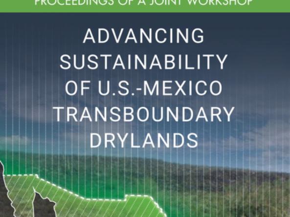
Elizabeth Weight, CIRES/NIDIS Regional Drought Information Systems Coordinator, represented NIDIS and CIRES in the May 2018 workshop “Advancing Sustainability of U.S.-Mexico Transboundary Drylands.” Ms. Weight’s contribution to the workshop, synthesized in the proceedings, focused on drought early warning systems as a potential innovative bi-national research collaboration and management solution for U.S.-Mexico transboundary drylands areas.

Published on

The Colorado Water Conservation Board (CWCB), part of the state’s Department of Natural Resources, has launched an interactive dashboard that displays drought vulnerability at the state and county level based on Colorado’s 2018 Drought Plan. An Esri Story Map, the platform takes users through visual summaries of Colorado drought risk by sectors, using images and graphs to provide an interactive and engaging experience.

Published on

The Colorado River provides water to almost 40 million people and 4 million acres of farmland. Since 2000, historically dry conditions have added stress to the Colorado River’s water resources. As a result, the risk of reaching critically low elevations at Lakes Powell and Mead has increased nearly four-fold over the past decade. Critically low reservoir levels could affect compliance with the 1922 Colorado River Compact; Lake Powell could drop below the level required to generate hydropower; and the economies, livelihoods, and natural resources of the Basin states could be negatively impacted.

Published on

Kicked off in March 2017, the Sub-Seasonal Climate Forecast Rodeo comprised of a year-long, real-time forecasting competition. The Bureau of Reclamation sponsored the competition in partnership with NOAA, U.S. Geological Survey, U.S. Army Corps of Engineers, and California Department of Water Resources.

Published on

Droughts are not commonly thought of as public health threats. The often-slow onset of drought, compared to other extremes, makes it difficult to identify the links between the physical characteristics of drought and societal impacts. California is no stranger to drought, and the most recent drought brought to the forefront the impacts of drought on health, including decreased water quantity and quality, coccidioidomycosis (Valley fever) outbreaks, increased mortality rates, and adverse mental health outcomes as livelihoods are challenged. In a post-drought coordination workshop, the California-Nevada Drought Early Warning System network identified better preparing public health professionals for drought as a priority.

Published on

The 2019 Biennial U.S. Drought Monitor Forum in Bowling Green, KY, initially scheduled for March 19–21, 2019, will be postponed until later this year. With the uncertainty of another federal government shutdown after February 15, the backlog of work that must be completed from the recent shutdown, and several USDM authors that could not now attend the Forum in mid-March, all 11 USDM authors voted for postponement.

Published on

In order to help communities understand and prepare for the various hazards that could impact their people, infrastructure, and economies, FEMA has developed a risk assessment process to identify and determine their level of vulnerability to these risks. FEMA’s Threat and Hazard Identification and Risk Assessment (THIRA) is a three-step risk assessment process that helps states, tribes, territories, and local communities answer the following questions: What threats and hazards can affect our community? If they occurred, what impacts would those threats and hazards have on our community? Based on those impacts, what capabilities should our community have?

Published on

According to news reports, the United States has been experiencing a nationwide Christmas tree shortage, along with price hikes as a result of low supplies. The U.S. Christmas tree industry is a $2 billion a year industry, according to annual reports from the National Christmas Tree Association.

Published on

It is well-known within the weather forecasting community that the United States experiences the most extreme weather events in the world. Tornado outbreaks can shatter communities in the central and southeastern parts of the country. Historical flooding can flip flop with crippling drought. Blizzards can paralyze the entire Northeast. As Americans, we see it all, and the emotional and financial impacts can be staggering. Economic losses from extreme weather events are measured in the billions of dollars annually and it is tough to put a price on a life taken too quickly or a way of life completely disrupted.