The National Coordinated Soil Moisture Monitoring Network
Transforming Soil Moisture Information Delivery
Soil moisture is a critical land surface variable, and an accurate depiction of soil moisture conditions can provide valuable insights for agricultural monitoring, weather prediction, and drought and flood early warning. The United States has a prolific but disconnected collection of in situ (“in place,” i.e., in-ground) soil moisture monitoring networks at the national, state, and local levels, as well as various satellite and modeling efforts that generate soil moisture data. The absence of coordination leads to a host of problems, including many states lacking adequate monitoring, multiple datasets that are not standardized or directly comparable, and lack of clarity around how to target investments to improve the overall monitoring infrastructure. National coordination is needed to guide network deployment, data integration, and user-focused product development.
Working with the USDA and other partners, NIDIS is leading the efforts of the National Coordinated Soil Moisture Monitoring Network (NCSMMN): a multi-agency, multi-institutional initiative to integrate soil moisture data from around the country and to capitalize on its transformative potential for a wide range of applications across sectors of the economy.
For more information, read this NCSMMN fact sheet or contact soil.moisture@noaa.gov.
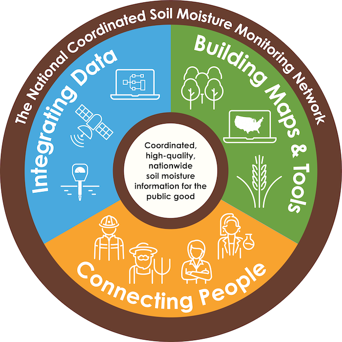
What Is the NCSMMN?
The National Coordinated Soil Moisture Monitoring Network (NCSMMN) aims to deliver high-quality, easy-to-understand soil moisture products and tools to support better hazard early warning systems; reduce risks from hazards such as drought, flood, and fire; improve crop production and resilience; and improve characterization of water budgets and climate models.
Want to learn more and become a part of the National Coordinated Soil Moisture Monitoring Network Community?

NCSMMN Goals and Accomplishments
Goals of the Interagency NCSMMN
- Establish a national “network of networks” that effectively demonstrates data and operational coordination of in situ networks and addresses gaps in coverage
- Build a community of practice and expertise around soil moisture measurement and interpretation—a “network of people” that links data providers, researchers, and the user community
- Support R&D on innovative techniques to merge in situ soil moisture data with remotely-sensed and modeled hydrologic data to create near-real-time, gridded, user-friendly soil moisture maps and associated tools
Early Successes of the NCSMMN

NIDIS-Supported Research for the NCSMMN
National Research
Economic Value of Soil Moisture Information
Funded by NOAA’s National Integrated Drought Information System (NIDIS), economists from Oklahoma State University leveraged previous economic and scientific studies to generate conservative, mid-range, and high-end estimates of the existing and potential economic benefits of soil moisture information.
Installation Protocol for In Situ Soil Moisture Data Collection and Period of Record Evaluation
A team at the U.S. Geological Survey is providing guidance on key aspects of soil moisture monitoring, supported by NIDIS funding. The project's goals are to (1) improve the representativeness of in situ soil moisture data in drought monitoring and (2) support the priorities of the NCSMMN.
Topofire Soil Moisture Modeling to Support Drought Management and Develop an Updated KBDI for Wildfire Management
Researchers at the U.S. Forest Service and University of Montana, funded by NIDIS, are working to upgrade the Topofire model, a soil water balance model, to provide critical new tools to support drought management and wildfire danger assessment.
Regionally Focused Research
Partners and Resources
Key NIDIS Partners in the Network
NOAA | National Centers for Environmental Information
USDA | Agricultural Research Service
USDA | Natural Resources Conservation Service
USDA | Office of the Chief Economist
U.S. Geological Survey | Water Mission
NASA | Earth Sciences Division
National Ecological Observatory Network (NEON)
National Drought Mitigation Center
State mesonets, including South Dakota, Montana, Oklahoma, Kentucky, North Carolina, and others
Academic institutions, including Ohio State University, Oklahoma State University, Southern Illinois University, and others
Community Collaborative Rain, Hail, and Snow Network (CoCoRaHS)
Private-sector companies (e.g., soil moisture sensor vendors)
Additional Web Resources
Resources for Soil Moisture Network Operators
Understanding Upper Missouri River Basin Soil Moisture and Snowpack
Fact Sheet: National Coordinated Soil Moisture Monitoring Network (2024)
2023 National Soil Moisture Workshop: Agenda & Presentations
Strategy for the National Coordinated Soil Moisture Monitoring Network (2021) and Strategy Executive Summary (2021)
In Situ Soil Moisture Sensor Installation Protocol: JoVE (Caldwell et al., 2022)
Developing a Strategy for the National Coordinated Soil Moisture Monitoring Network, Vadose Zone Journal (2021)
U.S. Drought Portal | Soil Moisture Data & Maps
Building a One-Stop Shop for Soil Moisture InformationFact Sheet: NIDIS and Soil Moisture (2018)
National Soil Moisture Network Workshop 2016: Progress Made, Future Directions
Developing a Coordinated National Soil Moisture Network (2013)

Related Content
Data & Maps | Soil Moisture
Access tools to monitor observed data in crop, topsoil, and soil moisture, surface water, changes and anomalies, water storage, soil moisture outlooks, and more.
Research & Learn | Flash Drought
In its simplest form, flash drought is generally considered the rapid onset of drought, which can cause extensive, unexpected damage to agriculture and economies. Changes in soil moisture can provide an early warning of flash drought.
Resources for Soil Moisture Network Operators
Robust, usable datasets start with good data collection. This page provides resources for managers and staff of long-term soil moisture monitoring networks, curated by the National Coordinated Soil Moisture Monitoring Network.