The U.S. government is closed. This site will not be updated; however, NOAA websites and social media channels necessary to protect lives and property will be maintained. To learn more, visit commerce.gov.
For the latest forecasts and critical weather information, visit weather.gov.
Logo
                           
  Related Data & Maps
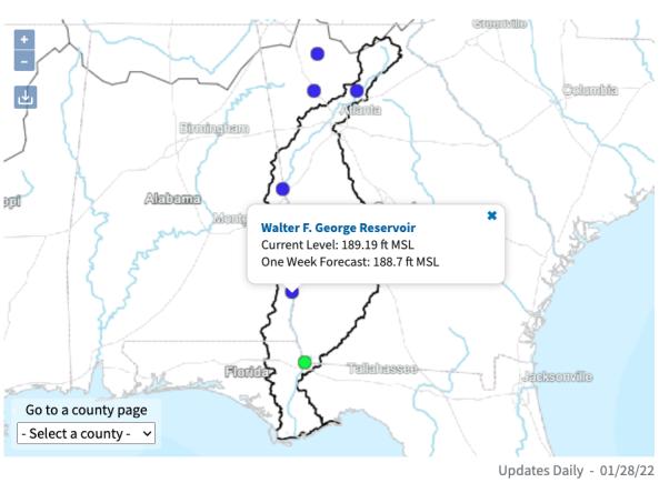
                          The ACF River Basin Drought and Water Dashboard is a web-based application that allows decision makers to view real-time information on the ACF River Basin all in one place.
File Format
                      images
                      csv
                      json
                      xml
                                        Related Events
                          Related Drought Status Updates
                          December 16, 2020


  Related News
                          Site Section
                          News & Events
                      The Apalachicola, Chattahoochee, and Flint (ACF) Rivers, along with the Apalachicola Bay, link the people and natural systems of Alabama, Florida, and Georgia. Balancing the water needs between three states and various sectors creates complex water management challenges, which are further intensified during times of drought. 
In response to a request by regional stakeholders, and in close


