U.S. flag

An official website of the United States government

DATA & MAPS

Select categories to browse data

Looking to Download Data? The Drought.gov team reformats data from multiple partners into web- and GIS-ready formats, which we use throughout Drought.gov. These data are free for all to download.
Search Results(190)

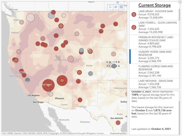
The Bureau of Reclamation's interactive Reservoir Storage Dashboard provides current conditions for 44 major Reclamation reservoirs and comparisons with historical storage data.

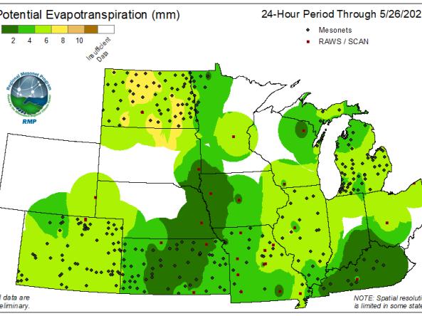
he Regional Mesonets And Partners Project (RMP) produces Potential Evapotranspiration (PET) maps at 24-hour and 7-day intervals for the Midwest region.

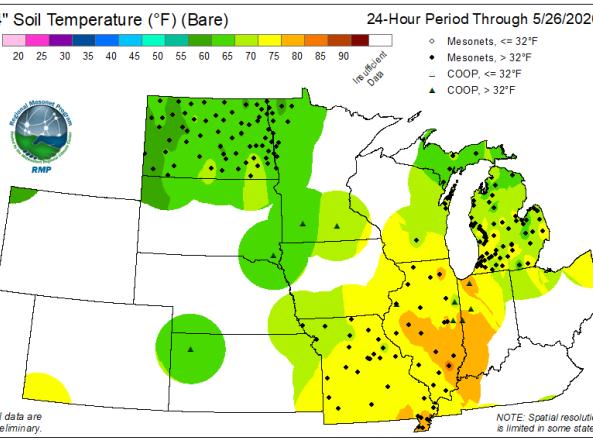
The Regional Mesonet Program (RMP) produces Soil Temperature maps at 2-inch and 4-inch depth for both bare soil and sod for the Midwest region.

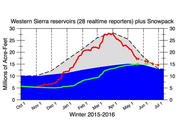
The CNAP Sierra Nevada Water Storage Tracker provides daily reservoir storage and snowpack information.