U.S. flag

An official website of the United States government

DATA & MAPS

Select categories to browse data

Looking to Download Data? The Drought.gov team reformats data from multiple partners into web- and GIS-ready formats, which we use throughout Drought.gov. These data are free for all to download.
Search Results(190)

A list of publications and other resources addressing water use, soil moisture management, water quality, and water conservation.

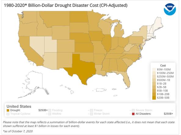
The National Centers for Environmental Information's Billion-Dollar Weather and Climate Disasters shows the weather and climate events that have had the greatest economic impact from 1980

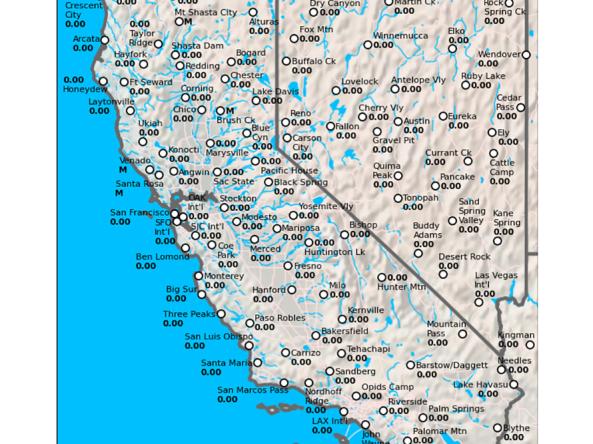
The California Data Exchange Center is a centralized database that stores, processes, and exchanges real-time hydrologic information on precipitation, river forecast, river stages/flow, snow, and r

CDC's Social Vulnerability Index uses 15 census variables at tract level to help local officials identify communities that may need support in preparing for hazards or recovering from disaster