
Record Warmth and Expansive Drought Grip Arkansas, Louisiana, and Mississippi
Potential Winter Improvement on the Horizon
Key Points
- Drought rapidly intensified across the Arkansas-Louisiana-Mississippi region since August. All three states experienced their warmest August–October period on record, accompanied by near-record dryness (3rd driest in Arkansas, 4th driest in Louisiana, and 5th driest in Mississippi).
- According to the U.S. Drought Monitor, 94% of the Arkansas-Louisiana-Mississippi region is in Moderate to Exceptional Drought (D1-D4), including 97% of Arkansas (almost 50% in Exceptional Drought), 95% of Louisiana, and 92% of Mississippi.
- Significant drought impacts have escalated over the last few months. Fire risk has been high this week, with moderate risk through the weekend, resulting in many areas issuing burn and outdoor fire bans. Agriculture is heavily strained by conditions harming row crops and livestock production. Water levels are significantly depleted, impacting wetlands, local wildlife, and communities.
- On the main stem of the Mississippi River, high flows from the Upper Mississippi are temporarily providing low-flow relief along the Lower Mississippi River. However, key points like Baton Rouge remain below their long-term average. Without significant rainfall in upstream basins, river levels could fall below normal, potentially impacting navigation and industry.
- Despite short-term elevated fire risks due to minimal near-term precipitation, a strengthening El Niño increases the likelihood of above-normal precipitation, supporting expected drought improvement or removal across much of the region by January 2027.
This update is based on data available as of Thursday, November 12, 2026 at 8:00 a.m. CT. We acknowledge that conditions are evolving.
U.S. Drought Monitor map for November 12, 2026, showing widespread, Severe to Exceptional Drought (D2–D4) conditions across Arkansas, Louisiana, and Mississippi. A large core of Exceptional Drought (D4) covers southern Arkansas, central Louisiana, and western/northern Mississippi, surrounded by extensive areas of Extreme Drought (D3) spanning nearly all of Arkansas, Louisiana, and Mississippi. Severe Drought (D2) blankets most of the remaining portions of these three states, with only coastal Louisiana and southeastern Mississippi experiencing milder Moderate Drought (D1) or Abnormally Dry (D0) conditions.
A drought index combines multiple drought indicators (e.g., precipitation, temperature, soil moisture) to depict drought conditions. For some products, like the U.S. Drought Monitor, authors combine their analysis of drought indicators with input from local observers. Other drought indices, like the Standardized Precipitation Index (SPI), use an objective calculation to describe the severity, location, timing, and/or duration of drought.
Learn MorePeriods of drought can lead to inadequate water supply, threatening the health, safety, and welfare of communities. Streamflow, groundwater, reservoir, and snowpack data are key to monitoring and forecasting water supply.
Learn MoreDrought can reduce the water availability and water quality necessary for productive farms, ranches, and grazing lands, resulting in significant negative direct and indirect economic impacts to the agricultural sector. Monitoring agricultural drought typically focuses on examining levels of precipitation, evaporative demand, soil moisture, and surface/groundwater quantity and quality.
Learn MoreU.S. Drought Monitor Categories: Lower Mississippi States
D0 - Abnormally Dry
Abnormally Dry (D0) indicates a region that is going into or coming out of drought, according to the U.S. Drought Monitor.
D1 – Moderate Drought
Moderate Drought (D1) is the first of four drought categories (D1–D4), according to the U.S. Drought Monitor.
D2 – Severe Drought
Severe Drought (D2) is the second of four drought categories (D1–D4), according to the U.S. Drought Monitor.
D3 – Extreme Drought
Extreme Drought (D3) is the third of four drought categories (D1–D4), according to the U.S. Drought Monitor.
D4 – Exceptional Drought
Exceptional Drought (D4) is the most intense drought category, according to the U.S. Drought Monitor.
Total Area in Drought (D1–D4)
Percent area of the Lower Mississippi states (Arkansas, Louisiana, and Mississippi) currently in drought (D1–D4), according to the U.S. Drought Monitor.
U.S. Drought Monitor map for November 12, 2026, showing widespread, Severe to Exceptional Drought (D2–D4) conditions across Arkansas, Louisiana, and Mississippi. A large core of Exceptional Drought (D4) covers southern Arkansas, central Louisiana, and western/northern Mississippi, surrounded by extensive areas of Extreme Drought (D3) spanning nearly all of Arkansas, Louisiana, and Mississippi. Severe Drought (D2) blankets most of the remaining portions of these three states, with only coastal Louisiana and southeastern Mississippi experiencing milder Moderate Drought (D1) or Abnormally Dry (D0) conditions.
The U.S. Drought Monitor is updated weekly on Thursday mornings, with data valid through the previous Tuesday morning.
A drought index combines multiple drought indicators (e.g., precipitation, temperature, soil moisture) to depict drought conditions. For some products, like the U.S. Drought Monitor, authors combine their analysis of drought indicators with input from local observers. Other drought indices, like the Standardized Precipitation Index (SPI), use an objective calculation to describe the severity, location, timing, and/or duration of drought.
Learn MorePeriods of drought can lead to inadequate water supply, threatening the health, safety, and welfare of communities. Streamflow, groundwater, reservoir, and snowpack data are key to monitoring and forecasting water supply.
Learn MoreDrought can reduce the water availability and water quality necessary for productive farms, ranches, and grazing lands, resulting in significant negative direct and indirect economic impacts to the agricultural sector. Monitoring agricultural drought typically focuses on examining levels of precipitation, evaporative demand, soil moisture, and surface/groundwater quantity and quality.
Learn MoreCurrent Conditions and Impacts for the Lower Mississippi States

- Widespread drought in the region: According to the U.S. Drought Monitor, 94% of the Arkansas-Louisiana-Mississippi region is in Moderate to Exceptional Drought (D1-D4), including 97% of Arkansas (almost 50% in Exceptional Drought), 95% of Louisiana, and 92% of Mississippi.
- Record high temperatures and near-record dryness: After a brief improvement in conditions this summer, drought intensified rapidly beginning in August, driven by persistent high temperatures and substantial precipitation deficits across all three states. As a result, Arkansas, Louisiana, and Mississippi experienced their warmest August–October period on record, accompanied by near-record dryness (3rd driest in Arkansas, 4th driest in Louisiana, and 5th driest in Mississippi).
- Lower than normal streamflow: Streamflows are low to much-below normal across the region. While high flows from the Upper Mississippi are temporarily providing low-flow relief along the Lower Mississippi River, key points like Baton Rouge remain below their long-term average. Without significant rainfall in the Upper Mississippi or Ohio River Valleys, river levels could fall below normal, potentially impacting navigation and industry.
- Significant drought impacts increased over the last few months:
- Persistent dry weather triggered a surge in outdoor fires and burn bans across dozens of counties and parishes in Arkansas, Louisiana, and Mississippi.
- Ranchers faced severe challenges maintaining cattle and crops due to dried-up water sources, forcing daily hay feeding and expensive water hauling across all three states. According to the U.S. Department of Agriculture, 76% of pastures are reported to be in poor to very poor condition.
- Water levels dropped significantly in local water bodies and reservoirs—such as Brewer Lake dropping nearly 15 feet in Conway, Arkansas and parts of Deer Creek drying up in Mississippi—leading to mandatory water curtailments, restricted lawn watering, and concerns for local wildlife.
- Long-term drought conditions took a heavy toll on Arkansas wetlands, threatening the upcoming duck hunting season by limiting water availability for flooding moist-soil units, while trees across the Ozarks suffered heat stress and dropped leaves early.
Louisiana Drought Rapidly Intensifies: From Drought-Free to Exceptional Drought (D4) in Three Months

Outlooks and Potential Impacts for the Lower Mississippi States
- Elevated fire risk: Fire risk is elevated across the Arkansas-Louisiana-Mississippi region through this coming weekend (November 12-15) due to minimal precipitation in the forecast.
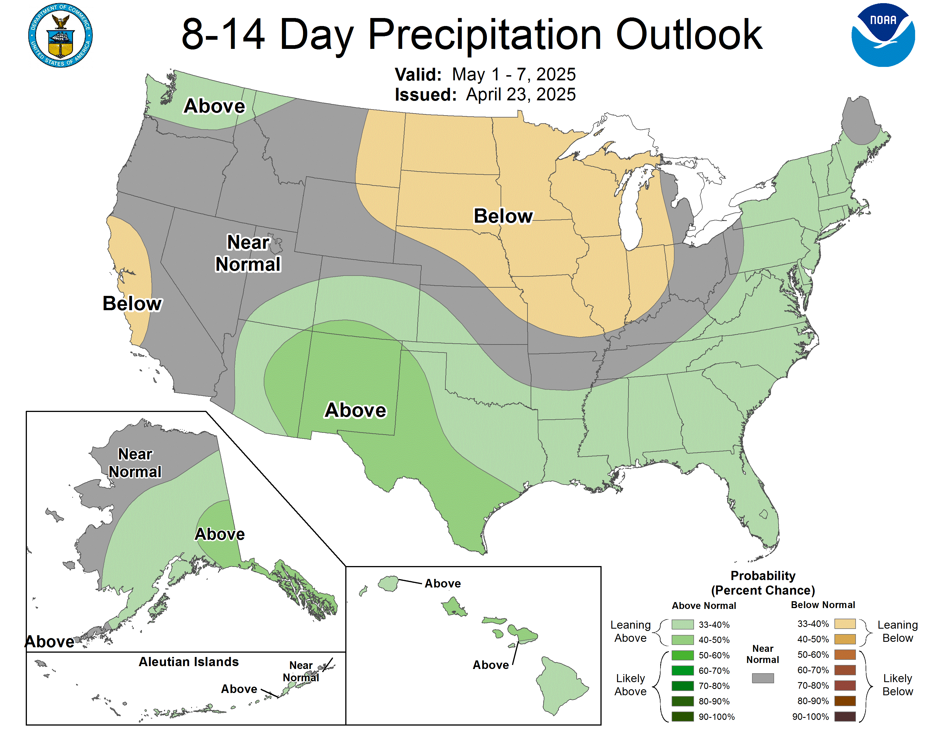
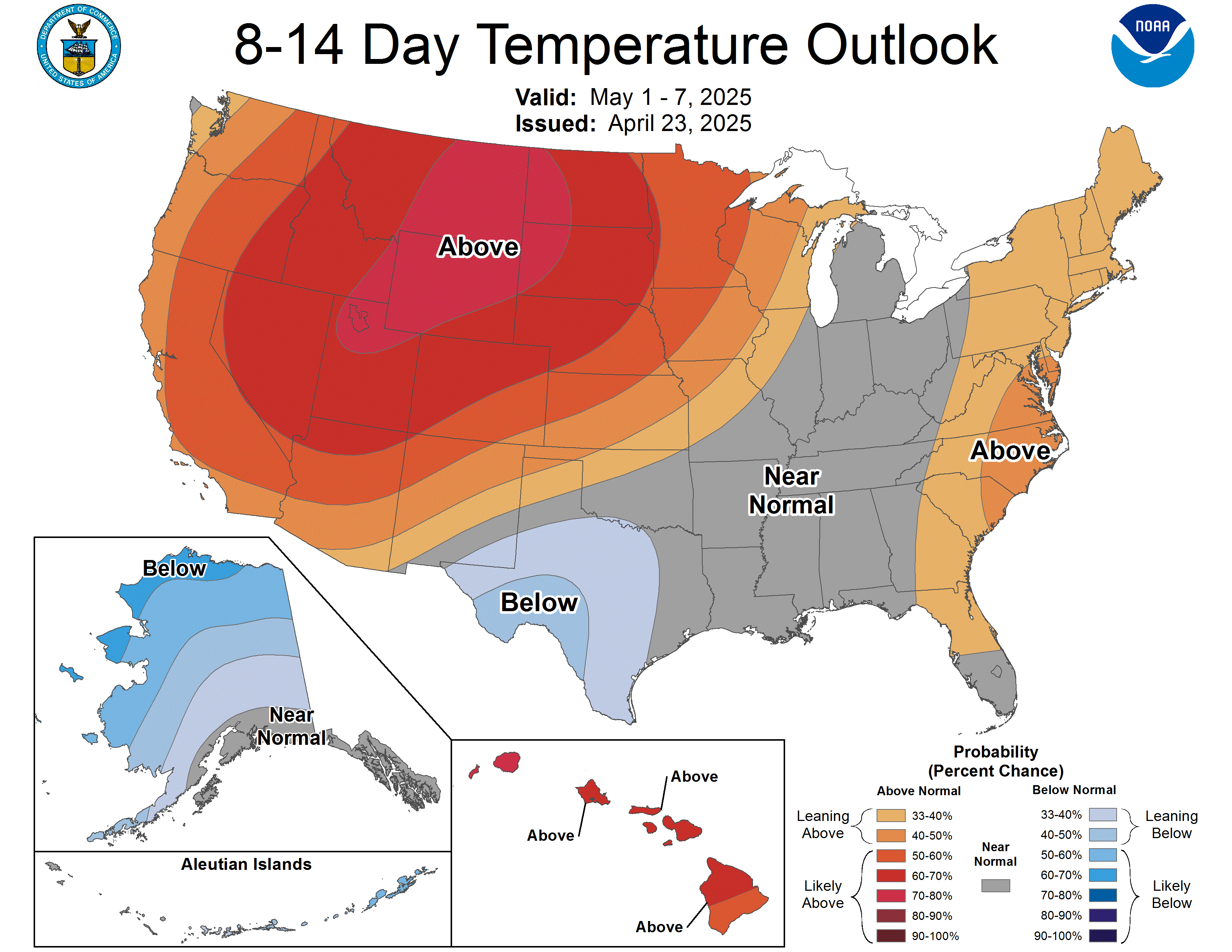
- Chance of above-normal precipitation in coming weeks: There are increased chances for above-normal precipitation during the November 20-26 time frame, with above-normal temperatures expected during this time frame as well.
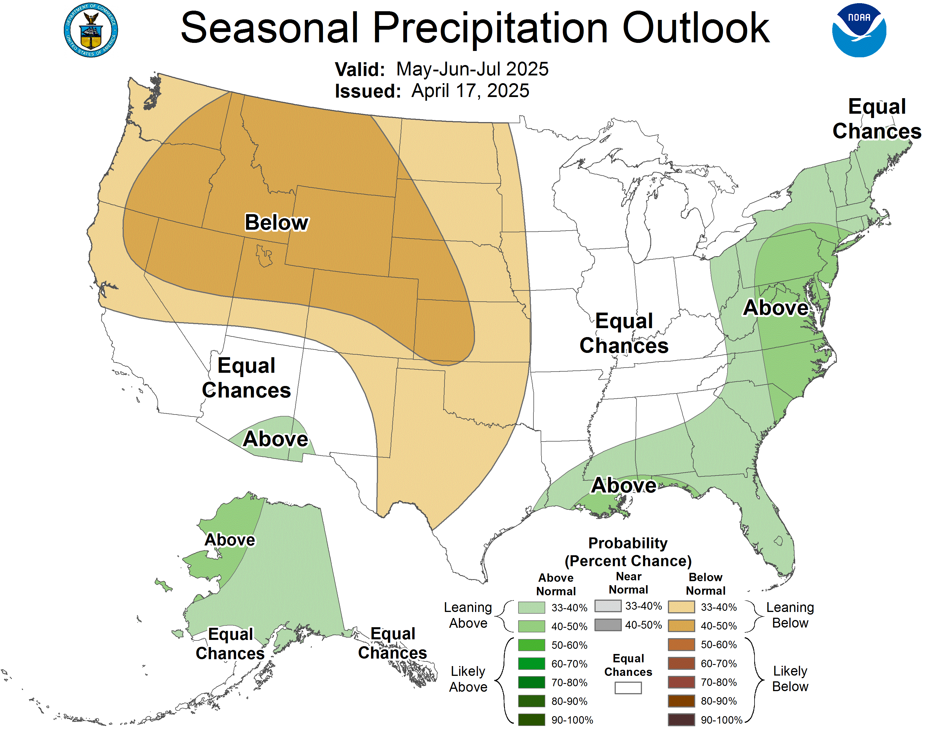
- Drought improvement expected this winter: The 3-month seasonal outlook for precipitation calls for increased chances of above-normal precipitation across the Arkansas-Louisiana-Mississippi region. Therefore, drought is expected to improve across much of the region by the end of January 2027. Portions of eastern Mississippi and southeast Louisiana where drought is less severe may see drought completely removed.
- Potential precipitation in Lower Mississippi Valley unlikely to help the Mississippi’s streamflows: Seasonal outlooks from NOAA’s National Weather Service (NWS) show above-average chances for precipitation in the Lower Mississippi Valley. However, due to the narrow and relatively flat nature of the basin in this area, rainfall there rarely has significant impacts to the Mississippi’s streamflows. The experimental 28-day forecast plots from the NWS Lower Mississippi River Forecast Center show all locations on the Lower Mississippi staying above low flow thresholds through the 28-day forecast period.
- El Niño influence in winter may bring drought relief to some areas: An El Niño Advisory is in place. El Niño continues to strengthen, with a strong-to-very strong El Niño likely through January-March 2027 (remaining greater than an 83% chance).
- El Niño has the strongest influence during the winter months, when weather patterns in the Arkansas-Louisiana-Mississippi region tend to be wetter across Louisiana and southern Mississippi, and a weaker tendency toward wetness farther north across Arkansas and northern Mississippi.
Moderate Significant Fire Potential Through this Weekend Across Arkansas-Louisiana-Mississippi Region

Drought Improvement or Removal Likely by the End of January Across Most of the Arkansas-Louisiana-Mississippi Region

Additional Resources
Regional Monitoring Resources
- Mississippi River Basin Drought and Water Dashboard, U.S. Drought Portal
- Waterway and Drought, Southern Regional Weather Records Center
- Integrated Water Portal, Southern Regional Weather Records Center
- Drought Tool, Southern Regional Weather Records Center
Additional Resources by State
More local information is available from the following resources:
- Your state page on Drought.gov:
- Sign up for Arkansas-Louisiana-Mississippi Region Drought Updates from NIDIS
- National Weather Service Drought Information Statements:
- November 6, 2026: Jackson, Mississippi
- November 5, 2026: Lake Charles, Louisiana
- October 30, 2026: Little Rock, Arkansas
- October 26, 2026: Memphis, Tennessee
- October 9, 2026: Tulsa, Oklahoma
- To report or view local drought impact information:
Prepared By
Molly Woloszyn, Joel Lisonbee
Cooperative Institute for Research in Environmental Sciences/University of Colorado Boulder and NOAA’s National Integrated Drought Information System
Elliot Wickham
Cooperative Institute for Research to Operational Hydrology/University of Alabama and NOAA’s National Integrated Drought Information System
John Nielsen-Gammon
Southern Regional Climate Center, Texas A&M University
Matt Wilson
NOAA National Weather Service, Lower Mississippi River Forecast Center
Mike Brown
Mississippi State Climate Office, Mississippi State University
Chris Buonanno
NOAA National Weather Service Little Rock Weather Forecast Office
This Drought Status Update is issued in partnership between the National Oceanic and Atmospheric Administration (NOAA) and partners to communicate a potential area of concern for drought expansion and/or development within Arkansas, Louisiana, and Mississippi based on recent conditions and the upcoming forecast. NIDIS and its partners will issue future Drought Status Updates as conditions evolve. NIDIS is an interagency program within the Climate Program Office, which is part of NOAA’s Office of Oceanic and Atmospheric Research.